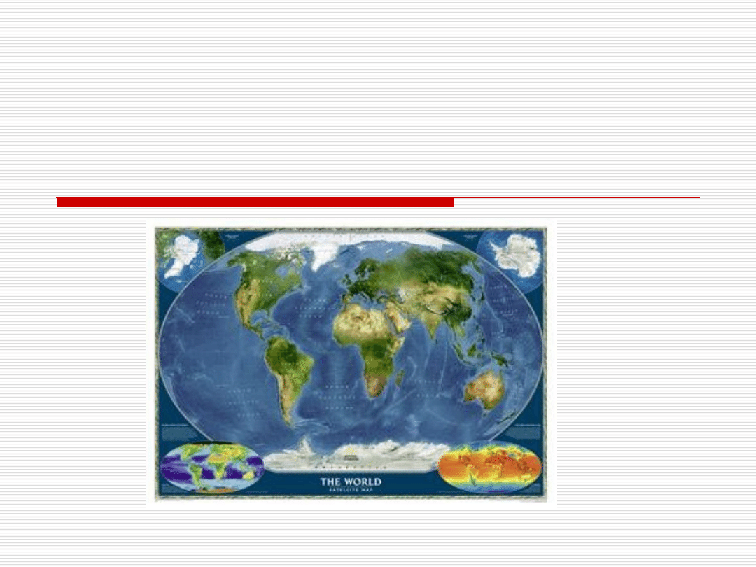
The Law of the Sea

The Law of the Sea
History
Sources of the law of the sea
Codification
The Hague Codification Conference of 1930
UNCLOS I 1958
UNCLOS II 1960
UNCLOS III 1973-1982
1982 United Nations Convention on the Law
of the Sea

The Law of the Sea
Maritime areas:
Baselines
Territorial Sea
Contiguous Zone
Exclusive Economic Zone
Continental Shelf
High Seas
The Area
Archipelagic Waters
International Straits

The Law of the Sea
Delimitation of Maritime Areas
The Sea-Bed Authority
Protection of the Marine Environment
Settlement of Disputes
Supplementary Reading

The Law of the Sea - History
The development of the law of the sea cannot be
separated from the development of international law in
general.
The modern law of the sea dates to the beginning of
modern international law in the middle of the 17
th
century.
However, there are many examples of collections of rules
and maritime customs in the Middle Ages (i.e. Rhodian Sea
Law, a Byzantine work compiled between 7
th
and 9
th
centuries,
12
th
century Rolls of Oleron from France, Consolato del Mare,
published in Barcelona in the middle of the 14
th
century,
Maritime Code of Wisby from approx. 1407, followed by the
Hanseatic League). Maritime customs began to be accepted
throughout Europe.

The Law of the Sea - History
Great geographical discoveries
In the 15
th
and 16
th
centuries claims were laid by the
powerful maritime states, especially Portugal and Spain,
to the exercise of sovereignty over vast portions of the
seas. Portugal claimed maritime sovereignty over
the whole of the Indian Ocean and a very big part of the
Atlantic. Spain claimed rights over the Pacific and the
Gulf of Mexico.
The division of the seas and oceans between Spain and
Portugal by the 1494 Treaty of Tordesillas was approved
by the Pope.

The Law of the Sea - History
Freedom of the seas
In opposition to the principle of maritime
sovereignty, the principle of the freedom of
the seas began to develop. The freedom of the
high seas was seen to correspond to the
general interests of all states, particularly as
regards freedom of commerce between
nations.

The Law of the Sea - History
Hugo Grotius (1583-1645)
Grotius, the Dutch lawyer who is considered to be the
father of international law, is regarded as the father of
the law of the sea as well. Grotius was one of the first to
attack claims to sovereignty over high seas.
In his seminal work on the subject, Mare Liberum (The Freedom of the
Seas), published in 1609, Grotius articulated the principle
of the freedom of the seas, meaning that the sea should
be free and open to use by all countries. His argument was
based on two grounds:
1.
No sea or ocean can be the property of a nation because it is
impossible for any nation effectively to take it into possession by
occupation.
2.
Nature does not give a right to anybody to appropriate things that
may be used by everybody and are exhaustible.

The Law of the Sea - Sources
Customary law
International treaties
1494 Treaty of Tordesillas
1774 Russia – Turkey on Perpetual Peace and Amity
1815 Act of the Congress of Vienna
1884 Paris Convention for the Protection of Submarine Cables
1888 Convention on the Free Navigation of the Suez Canal
1903 Panama – USA Convention for the Construction of a Ship
Canal
1907 Convention concerning the Rights and Duties of Neutral
Powers in Naval Warfare
1907 Convention relative to the Laying of Automatic Submarine
Contact Mines
1910 Brussels Convention for the Unification of certain Rules
relating to Assistance and Salvage at Sea
1923 Geneva Convention and Statute on the Regime of
Maritime Ports

The Law of the Sea - Codification
The Hague Codification Conference of 1930
The Conference was unable to adopt a
convention concerning territorial waters as no
agreement could be reached on the question
of the breadth of territorial waters and the
problem of the contiguous zone. There was,
however, some measure of agreement
regarding the legal status of territorial waters,
the right of innocent passage and the baseline
for measuring the territorial waters.

The Law of the Sea - Codification
UNCLOS I, Geneva 1958
Convention on the Territorial Sea and
Contiguous Zone
Convention on the Continental Shelf
Convention on the High Seas
Convention on the Fishing and
Conservation of Living Resources of
the High Seas

The Law of the Sea - Codification
UNCLOS II 1960
The main purpose of UNCLOS II was to
determine the breadth of the territorial
sea. The Conference failed to agree on
the British 6+6 compromise (6 miles
territorial sea + 6 miles contiguous
zone) proposal.

The Law of the Sea - Codification
UNCLOS III 1973-1982
UNCLOS III experience has been described as “the
largest, most technically complex,
continuous negotiation attempted in modern times”
(R.L. Friedheim).
UNCLOS III negotiated on the basis of consensus, as a
package deal with the understanding that no
reservations to the Convention be permitted.
On April 30 1982 The United Nations Convention on
the Law of the Sea was adopted by voting. 130 states
voted in favour, 4 against (USA, Israel, Turkey and
Venezuela) and 17 abstained.

The Law of the Sea - Codification
1982 United Nations Convention on the Law of the Sea
The United Nations Law of the Sea Convention was
signed by 117 states on December 10, 1982 in
Montego Bay, Jamaica.
The Convention entered into force in on November 16,
1994 after being ratified by 60 states.
The Convention consists of 17 parts with 320 articles
and 9 annexes
The Convention is a comprehensive code of rules of
international law on the sea. The greater part of the
Convention reflects already existing customary and
conventional (1958 Conventions) law of the sea.
However, much of the previous law was thereby
changed and many new rules introduced.

Baselines
Normal baseline (Article 5)
The normal baseline for measuring the breadth of the territorial sea is
the low water line along the coast as marked on large-scale charts
officially recognized by the coastal State.
Straight baselines (Article 7)
In localities where the coastline is deeply indented and cut into, or if
there is a fringe of islands along the coast in its immediate vicinity, the
method of straight baselines joining appropriate points may be
employed in drawing the baseline from which the breadth of the
territorial sea is measured.
Combination of methods for determining baselines (Article 14)
The coastal State may determine baselines in turn by any of the
methods provided for in the foregoing articles to suit different
conditions.

Internal Waters
Internal waters (Article 8)
Waters on the landward side of the baseline of the territorial sea form
part of the internal waters of the State.
Bays (Article10)
For the purposes of this Convention, a bay is a well-marked
indentation whose penetration is in such proportion to the width of
its mouth as to contain land-locked waters and constitute more
than a mere curvature of the coast. An indentation shall not,
however, be regarded as a bay unless its area is as large as, or
larger than, that of the semi-circle whose diameter is a line drawn
across the mouth of that indentation.
Where the distance between the low-water marks of the natural
entrance points of a bay exceeds 24 nautical miles, a straight
baseline of 24 nautical miles shall be drawn within the bay in such
a manner as to enclose the maximum area of water that is possible
with a line of that length.

Territorial Sea
Every State has the right to establish the
breadth of its territorial sea up to a limit not
exceeding 12 nautical miles, measured
from baselines determined in accordance
with this Convention (Article 3)
The outer limit of the territorial sea is the
line every point of which is at a distance
from the nearest point of the baseline equal
to the breadth of the territorial sea (Article
4)

TTerritorial Sea: Innocent Passage
Right of innocent passage (Article17)
Ships of all States, whether coastal or land-locked, enjoy the right
of innocent passage through the territorial sea.
Passage shall be continuous and expeditious.
However, passage includes stopping and anchoring, but only in so
far as the same are incidental to ordinary navigation or are
rendered necessary by force majeure or distress or for the purpose
of rendering assistance to persons, ships or aircraft in danger or
distress.
Passage is innocent so long as it is not prejudicial to the peace,
good order or security of the coastal State. The Convention (Article
19) includes a list of activities prejudicial to the peace, good order
or security of the coastal State (e.g. threat or use of force, exercise
with weapons, fishing, propaganda).

Contiguous Zone
Contiguous zone (Article33)
In a zone contiguous to its territorial sea, described as
the contiguous zone, the coastal State may exercise the
control necessary to:
(a) prevent infringement of its customs, fiscal,
immigration or sanitary laws and regulations within its
territory or territorial sea;
(b) punish infringement of the above laws and regulations
committed within its territory or territorial sea.
The contiguous zone may not extend beyond 24 nautical
miles from the baselines from which the breadth of the
territorial sea is measured.

Exclusive Economic Zone
The exclusive economic zone is an area beyond and adjacent to
the territorial sea.
In the exclusive economic zone, the coastal State has:
(a)
sovereign rights for the purpose of exploring and exploiting,
conserving and managing the natural resources, whether living or non
living, of the waters superjacent to the seabed and of the seabed and
its subsoil, and with regard to other activities for the economic
exploitation and exploration of the zone, such as the production of
energy from the water, currents and winds;
(b) jurisdiction as provided for in the relevant provisions of this Convention with
regard to:
(i) the establishment and use of artificial islands, installations and structures;
(ii) marine scientific research;
(iii) the protection and preservation of the marine environment.
The exclusive economic zone shall not extend beyond 200 nautical miles
from the baselines from which the breadth of the territorial sea is measured.

Continental Shelf
The continental shelf of a coastal State
comprises the seabed and subsoil of the submarine areas
that extend beyond its territorial sea throughout the
natural prolongation of its land territory to the outer
edge of the continental margin, or to a distance of
200 nautical miles from the baselines from which the
breadth of the territorial sea is measured where the outer
edge of the continental margin does not extend up to that
distance.
the outer limit of the continental shelf shall not
exceed 350 nautical miles from the baselines from which
the breadth of the territorial sea is measured.

High Seas
High seas regime applies in all parts of the sea that are not
included in the
exclusive economic zone, in the territorial sea or in the internal
waters
of a State, or in the archipelagic waters of an archipelagic State
The high seas are open to all States, whether coastal or
land-locked. It comprises, inter alia, both for coastal and
land-locked States:
(a) freedom of navigation;
(b) freedom of overflight;
(c) freedom to lay submarine cables and pipelines;
(d) freedom to construct artificial islands and other installations
permitted under international law;
(e) freedom of fishing;
(f) freedom of scientific research.

The Area
The Area and its resources are the common heritage
of mankind (Article 136)
No State shall claim or exercise sovereignty or
sovereign rights over any part of the Area or its
resources, nor shall any State or natural or juridical
person appropriate any part thereof. No such claim or
exercise of sovereignty or sovereign rights nor such
appropriation shall be recognized.
All rights in the resources of the Area are vested in
mankind as a whole, on whose behalf the Authority shall
act.

STRAITS USED FOR INTERNATIONAL
NAVIGATION
Straits used for international navigations are straits which
are used for international navigation between one part of the
high seas or an exclusive economic zone and another part of
the high seas or an exclusive economic zone.
In international straits all ships and aircraft enjoy the right
of transit passage, which shall not be impeded.
Transit passage means the exercise of the freedom of
navigation and overflight solely for the purpose of continuous
and expeditious transit between one part of the high seas or an
exclusive economic zone and another part of the high seas or
an exclusive economic zone.
States bordering straits may designate sea lanes and
prescribe traffic separation schemes for navigation in straits where
necessary to promote the safe passage of ships.
There shall be no suspension of transit passage.

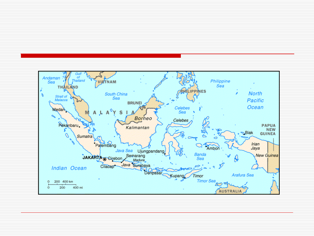
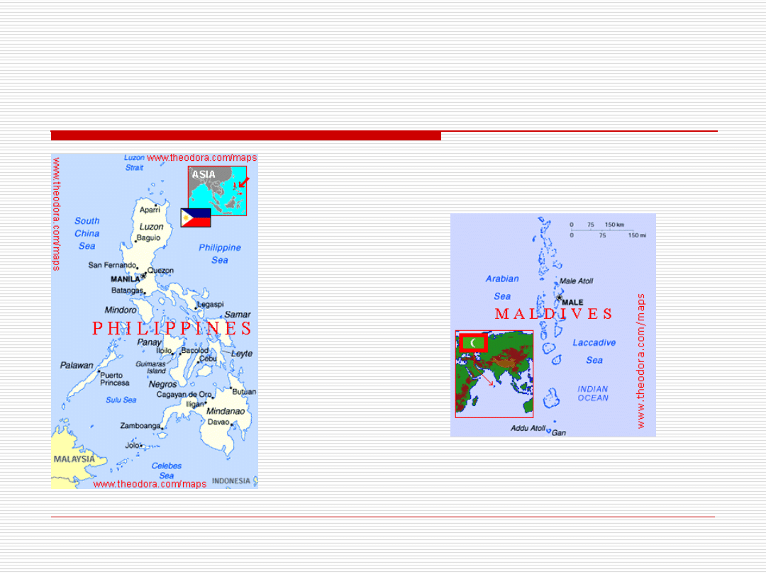
Archipelagic States
"archipelagic State" means a State constituted wholly
by one or more archipelagos and may include other islands
(Indonesia, for instance, consists of 17 508 islands);
"archipelago" means a group of islands, including parts of islands.
An archipelagic State may draw straight archipelagic baselines
joining the outermost points of the outermost islands of the
archipelago provided that within such baselines are included the
main islands and an area in which the ratio of the area of the water
to the area of the land, including atolls, is between 1 to 1 and 9 to
1.
The length of such baselines shall, in principle, not
exceed 100 nautical miles.
The breadth of the territorial sea, the contiguous zone, the
exclusive economic zone and the continental shelf shall be
measured from archipelagic baselines.
Archipelagic States
Archipelagic States

Archipelagic States - Archipelagic
Sea Lanes Passage
The breadth of the territorial sea, the contiguous zone, the
exclusive economic zone and the continental shelf shall be measured
from archipelagic baselines drawn in accordance with article 47.
The sovereignty of an archipelagic State extends to the waters
enclosed by the archipelagic baselines. This sovereignty extends to the
air space over the archipelagic waters, as well as to their bed and
subsoil, and the resources contained therein.
All ships and aircraft enjoy the right of archipelagic sea lanes
passage in such sea lanes and air routes.
Archipelagic sea lanes passage means the exercise in accordance
with this Convention of the rights of navigation and overflight in the
Normal mode solely for the purpose of continuous, expeditious and
Unobstructed transit between one part of the high seas or an exclusive
economic zone and another part of the high seas or an exclusive
economic zone.
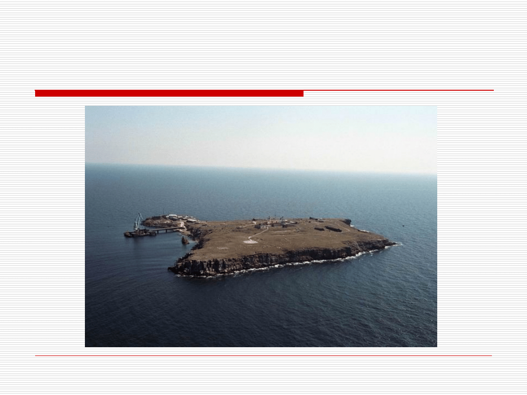
Delimitation of Maritime Areas –
Snake Island Case
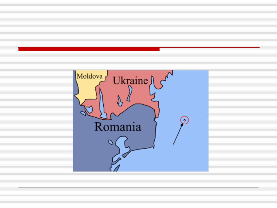
Delimitation of Maritime Areas –
Snake Island Case
Document Outline
- The Law of the Sea
- Slide 2
- Slide 3
- Slide 4
- The Law of the Sea - History
- Slide 6
- Slide 7
- Slide 8
- The Law of the Sea - Sources
- The Law of the Sea - Codification
- Slide 11
- Slide 12
- Slide 13
- Slide 14
- Baselines
- Internal Waters
- Territorial Sea
- TTerritorial Sea: Innocent Passage
- Contiguous Zone
- Exclusive Economic Zone
- Continental Shelf
- High Seas
- The Area
- STRAITS USED FOR INTERNATIONAL NAVIGATION
- Archipelagic States
- Slide 26
- Slide 27
- Archipelagic States - Archipelagic Sea Lanes Passage
- Delimitation of Maritime Areas – Snake Island Case
- Delimitation of Maritime Areas – Snake Island Case
Wyszukiwarka
Podobne podstrony:
dr berry introduction to the law of the sea
The law of the European Union
Men of the Sea 1 0
the tragic ending of bonaparte of the sea OZC7OZY65JPIDVN4IH4423GPPGVL5HUKVHRO66Y
Stare?cisis and the Law of Precedent
20,000 Leagues Under the Sea Analysis of the?ginning
Helsinki Principles on the Law of Maritime Neutrality
The Universal Law of Attraction
The law of the European Union
The law of attraction
Liber CL (The Law of Liberty) by Aleister Crowley
the law of one book 3
Liber DCCCXXXVII The Law of Liberty (Book 837)
Forstchen, William R Into the Sea of Stars
Law of the Wolf Tower Tanith Lee
The Law Of Attraction
Chains of the Sea Gardner Dozois
więcej podobnych podstron