6585845027
Belgium
8

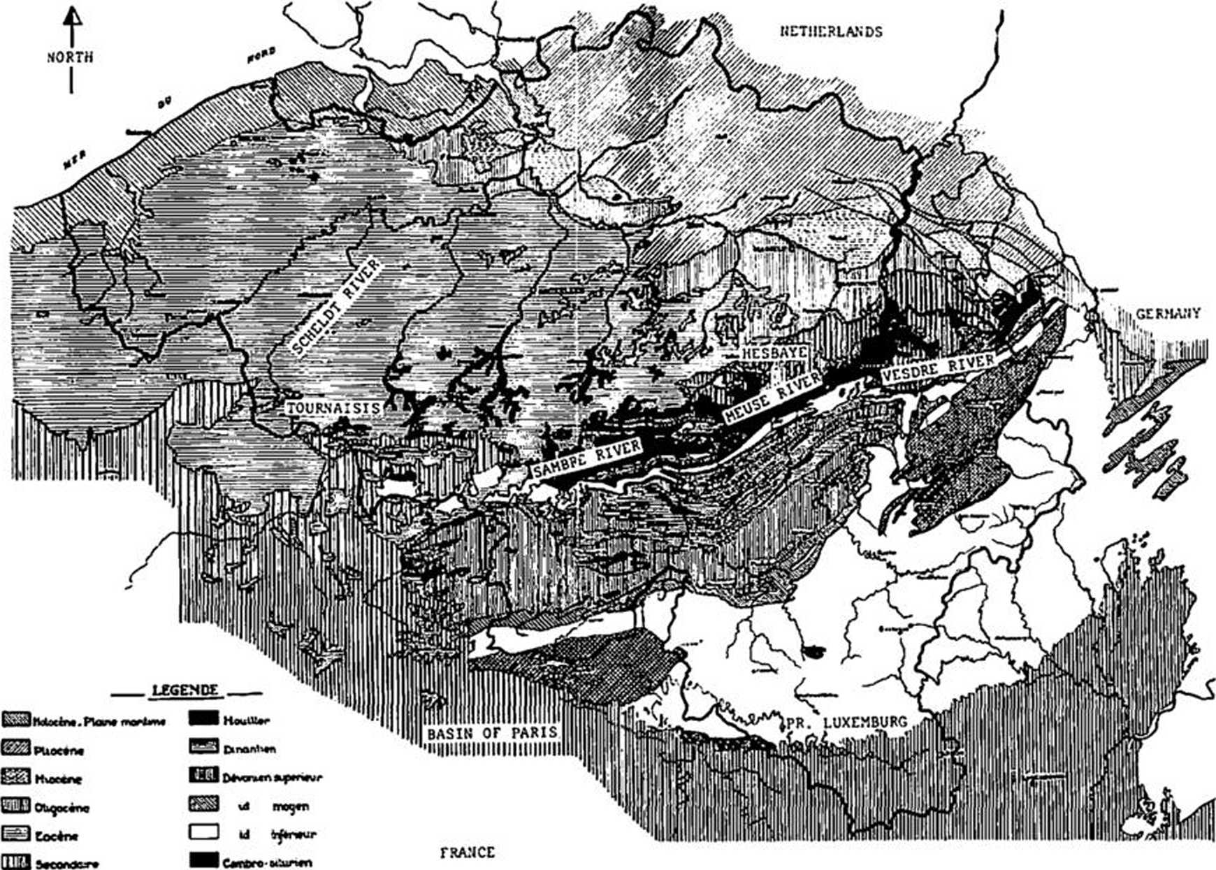
Fig. 1
oriented NE/SW in the east of the country and in a raore recent covering, discordant on the old substratum. The outcrop of the paleozoic layers proceeds from the erosion of the axial zonę of the dome.
Accordingly, the ground of the north part of Belgium is constituted by tertiary and ąuaternary formations. They are essentially constituted of sands and clays, which are loose formations, similar with the formations existing in the Netherlands : in these layers, the U8e of the static penetro-meter is the most favourable.
At the north of the axis Sambre-Meuse, the outcrops of cretaceous chalks in the Hesbaye and in the Tournaisis are constituted by less cohesive rocks but including many silex stone layers with at the top of the formation a residual silex banket with a thickness of 1 to 10 meter. It is necessary in this part of the country to use penetrometers eąuipped by a boring or a driving eąuipment in view of penetrating these hard layers.
In the south of Belgium, the primary
%
layers are constituted by rocks such as schist, sandstone, limestone,... over-laid by some meters of superficial deposits including sometimes gravels.
It is quite impossible to penetrate deeply into the primary layers but the penetrometers eąuipped by boring and driving eąuipment are used for the recognition of the superficial layers.
Ali at the south of Belgium, where secondary layers reappear, these are constituted by limestones and sand-stones offering the same resistance
Wyszukiwarka
Podobne podstrony:
24 JACEK LECH Fig. 27. Sąspów, Cracow dist. Cross section of shaft No 1 and portion of Shaft No 2 a
o dBFrequency (Hz) l— SO* (high) SD* (Iow) Fig. 2. Mean hearing levels in the ieft
S5003157 Fig. 1 Stara Słupia smelting site. The remains consist f " arranged in parallel rows w
S5003156 170 Fig. i Stara Słupia sneltlng site. The remains consist of slag pits arranged in paralle
95 Ryc. 14. Podregiony rekreacyjne w rejonie Wigier Fig. 14. Recreational subregions in the Lakc Wig
carving?ce4 34 Rangę of Expressions In the tace of Falstaff, Fig. 70, these reactions are the only s
DSC06791 Ryc. 18. Miejsce objęte projektem z 2004 r. (jesień 2008) Fig. 18. Place included in the pr
IMGR24 DRESSING THE SKINS bon cilicd Mns*U [Fig. i] no* fbund elscwhcrc in Europę, horned like a Ram
149 USSR tioally in the tom. ot graphs* Fig*3* Static sounding apparatua S-832 The meohanl8oi for so
w25E A: the castle of Imola, east of Bologna, as it would have appeared in the early 14th century. B
S5003156 170 Fig. i Stara Słupia sneltlng site. The remains consist of slag pits arranged in paralle
S5004026 SE Brittin: Horse Fig. 2.6 Various coins mentioned in the text Coin and the representation
więcej podobnych podstron