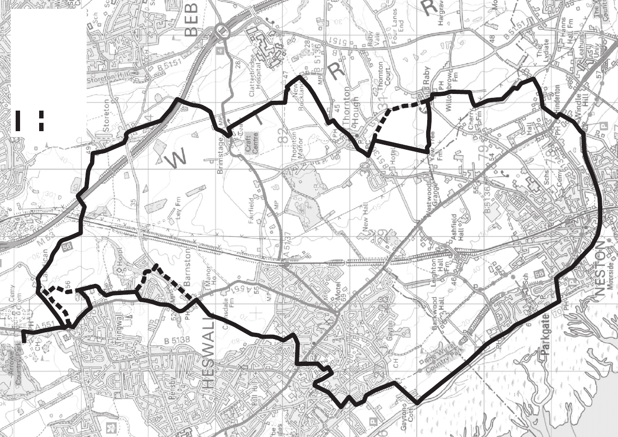
ARROWE PARK -
PARKGATE
CIRCULAR WALK
www.visitwirral.com/coast&countryside
Birkenhead
Wallasey
Hoylake
Heswall
New Brighton
West Kirby
Thurstaston
Eastham
Bebington
Rock Ferry
Leasowe
Port Sunlight
Tranmere
Brimstage
Neston
Parkgate
M53
J1
Storeton
Thornton
Hough
Barnston
Thingwall
J3
J2
J4
J5
J6
WIRRAL
Countryside code
From a gentle stroll or relaxing picnic to a long-distance walk or
heart-pumping adventure, the countryside provides every
opportunity for enjoyment and relaxation.
If you follow the Countryside Code wherever you go, you will get
the best enjoyment possible and you will help to protect the
countryside now and for future generations.
Useful contacts
• Be safe - plan ahead and follow any signs.
• Leave gates and property as you find them.
• Protect plants and animals, and take your litter home.
• Keep dogs under close control.
• Consider other people.
Welcome
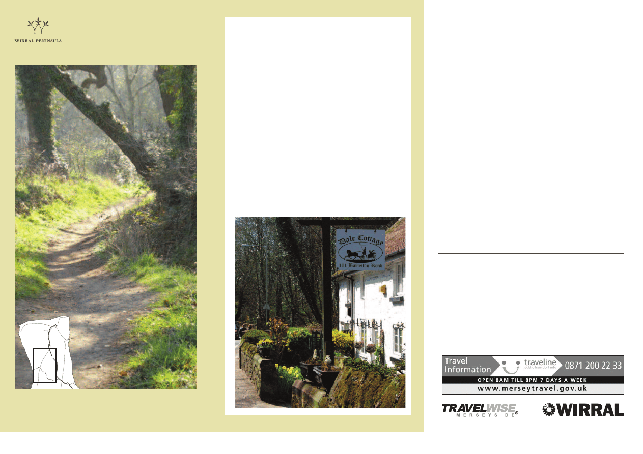
This 16 mile long circular trail is the end result
of long, ongoing consultations with Robin
Tutchings, Wirral Borough Council’s Footpath
Officer. The final selection of the paths to form
this trail was also assisted by fellow rambler,
Claire Gill, who gave similar valued support
when I was working to establish the Clwydian Way
in 2000 and the Alwen Trail in 2006. However, in
the Wirral our joint objective was to create a
reasonably long walking trail that would take
ramblers through some of the most attractive
parts of the mid-Wirral peninsular and, at the
same time, keep road-walking down to a
minimum. We hope you like the varied route
we have selected and enjoy your walk.
David Hollett, October 2012.
Cottages in Barnston Dip
Wirral Public Rights of Way
Office
t: 0151 606 2004
e: walking@wirral.gov.uk
www.visitwirral.com/walking
Parks & Countryside Manager
t: 0151 606 2004
www.wirral.gov.uk
Wirral Country Park,
Thurstaston
t: 0151 648 4371
e: coastalpark@wirral.gov.uk
North Wirral Coastal Park
t: 0151 648 4371
e: coastalpark@wirral.gov.uk
Travelwise
t: 0151 330 1253
e: info@LetsTravelWise.org
www.letstravelwise.org
Wirral Cycling Office
t: 0151 606 2004
e: cycling@wirral.gov.uk
www.visitwirral.com/cycling
Tourist Information
t: 0151 666 3188
www.visitwirral.com
Eastham Country Park
t: 0151 327 1007
Dibbinsdale
Local Nature Reserve
t: 0151 334 9851
Traveline
t: 0871 200 22 33
www.merseytravel.gov.uk
www.merseyferries.co.uk
a
77
a
27
2
a
85
a
77
a
27
2
a
85
a
27
2
a
27
2
a
85
a
77
a
77
a
27
2
a
77
a
85
a
85
a
85
a
27
2
a
27
2
a
27
2
©
C
ro
wn
co
py
rig
ht
a
nd
d
at
ab
as
e
rig
ht
s 2
01
2
Or
dn
an
ce
S
ur
ve
y
10
00
19
80
3.
Yo
u
ar
e
no
t p
er
m
itt
ed
to
co
py
, s
ub
-li
ce
ns
e,
d
ist
rib
ut
e
or
se
ll
an
y
of
th
is
da
ta
to
th
ird
p
ar
tie
s i
n
an
y
fo
rm
.
A
rr
o
w
e
P
a
rk
t
o
S
to
re
to
n
R
o
u
te
O
p
ti
o
n
a
l
ro
u
te
a
77
B
u
s
ro
u
te
1
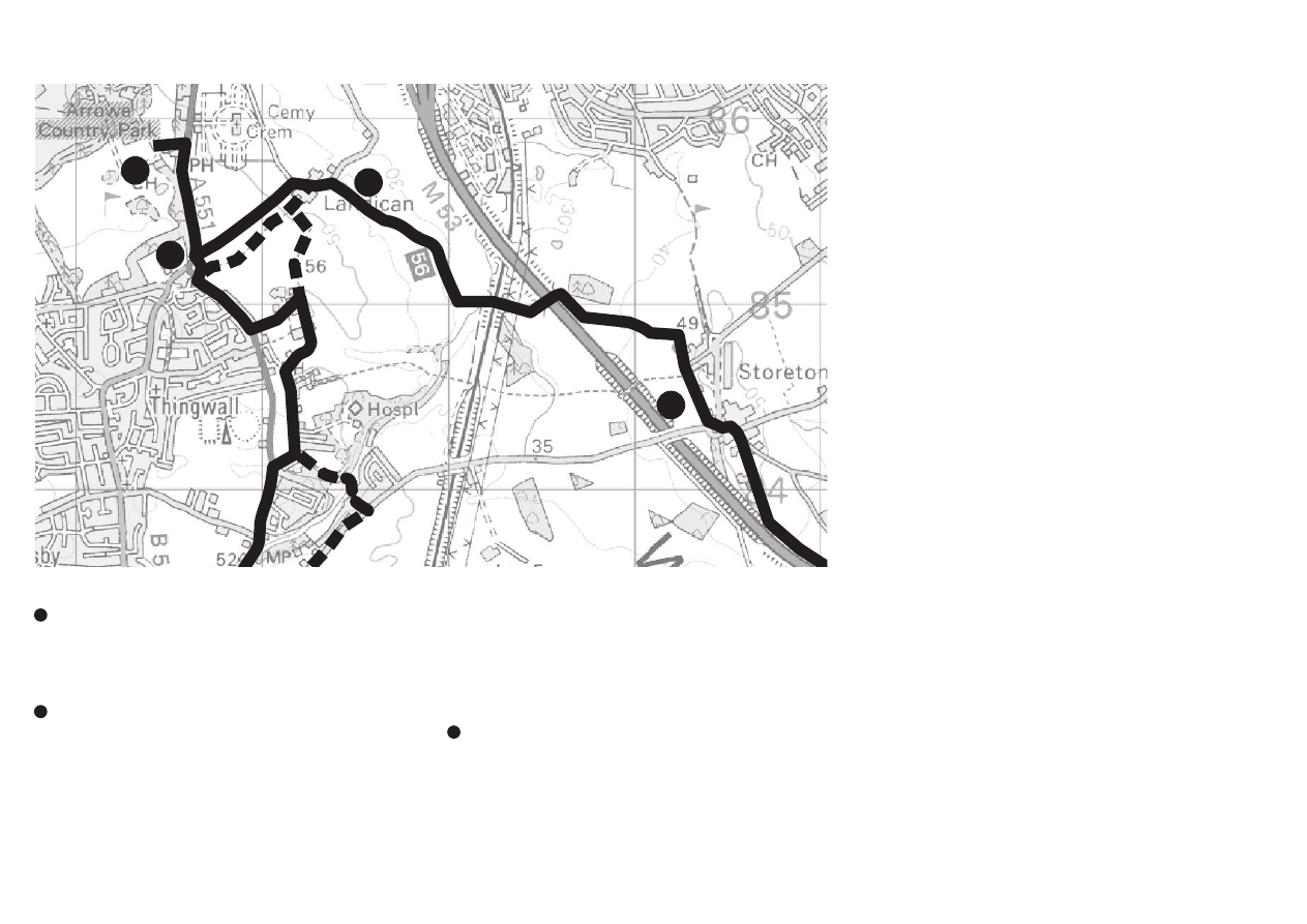
Arrowe Park - Landican
From the main Arrowe Country Park car park off
Arrowe Park Road that also doubles up as the Golf Club
and Cherry Orchard car parks, exit out of the main
entrance and turn right to go along the pavement of
Arrowe Park Road with the fields on your left.
As you approach Thingwall Corner roundabout you can
choose Option A: Turn left into Landican Road and walk
along the grass verge into Landican Village to the point
where the public footpath joins the road from the right.
Option B: On the far side of the roundabout on the left is
the stile and start on the public footpath. Enter the field
keeping the hedge on your left, over the railway sleeper
‘bridge’, straight across the next field keeping to the left of
the pond and then down to the track and exit into Landican
Lane. Please note, this route can get very muddy where
the footpath is shared with a large herd of cows! Follow
the footpath past the farm on your right out onto
Landican Lane.
Landican - Storeton
Continue along Landican Lane for about 200m and you
will see route 56 national cycle network signs for this lovely
well used bridleway that up to the Bidston - Wrexham
Railway is an avenue of mature oak trees with all the
wildlife that such habitats provide. The bridleway continues
under the M53 and comes out in Storeton village.
Arrowe Park - Storeton
a
77
a
272
a
77
a
272
1
1
2
3
2
3
4
©
C
ro
wn
co
py
rig
ht
a
nd
d
at
ab
as
e
rig
ht
s 2
01
2
Or
dn
an
ce
S
ur
ve
y
10
00
19
80
3.
Y
ou
a
re
n
ot
p
er
m
itt
ed
to
co
py
, s
ub
-li
ce
ns
e,
d
ist
rib
ut
e
or
se
ll
an
y
of
th
is
da
ta
to
th
ird
p
ar
tie
s i
n
an
y
fo
rm
.
2
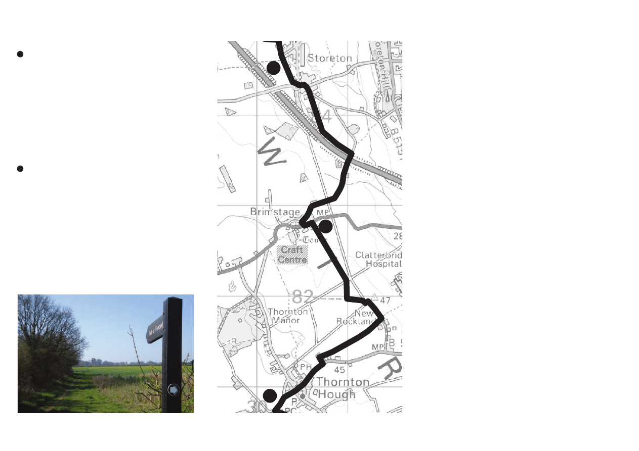
Storeton - Brimstage
At the end of Landican Lane, pass the T junction on the
left and the footpath to Thingwall on the right. Continue to
the end of the road. Negotiate the roundabout on the left to
leave the roundabout by the 2nd exit, Red Hill Road. Take
care: oncoming traffic without a pavement. Follow the road
round to the right and take the public footpath down the
track that veers right from the road towards Ivy Kennels
and Cattery. At the end of the track enter the field and walk
parallel to the M53. This path exits right onto Brimstage
Lane, under the motorway and follow this single track road
to Brimstage. Take care with oncoming traffic.
Brimstage - Thornton Hough
At the end of Brimstage Lane, cross over the main road.
You can turn right and visit the Craft Centre with a variety
of facilities. The route turns left and then immediate right
onto the public footpath over the stiles and across the fields,
across the Leverhulme access road, across the next field and
turn left onto the bridleway that leads across another
Leverhulme access road into Rocklands Lane. Soon on the
left you will see Thomas’s path that leads down to
Clatterbridge, and opposite is the footpath that goes across
more fields that exits onto Thornton Common Road.
Cross the road, turn right and follow the pavement into
the village of Thornton Hough.
Storeton - Thornton Hough
a
77
a
85
View form Rocklands Lane
4
5
4
5
6
©
C
ro
wn
co
py
rig
ht
a
nd
d
at
ab
as
e
rig
ht
s 2
01
2
Or
dn
an
ce
S
ur
ve
y
10
00
19
80
3.
Y
ou
a
re
n
ot
p
er
m
itt
ed
to
co
py
, s
ub
-li
ce
ns
e,
d
ist
rib
ut
e
or
se
ll
an
y
of
th
is
da
ta
to
th
ird
p
ar
tie
s i
n
an
y
fo
rm
.
3
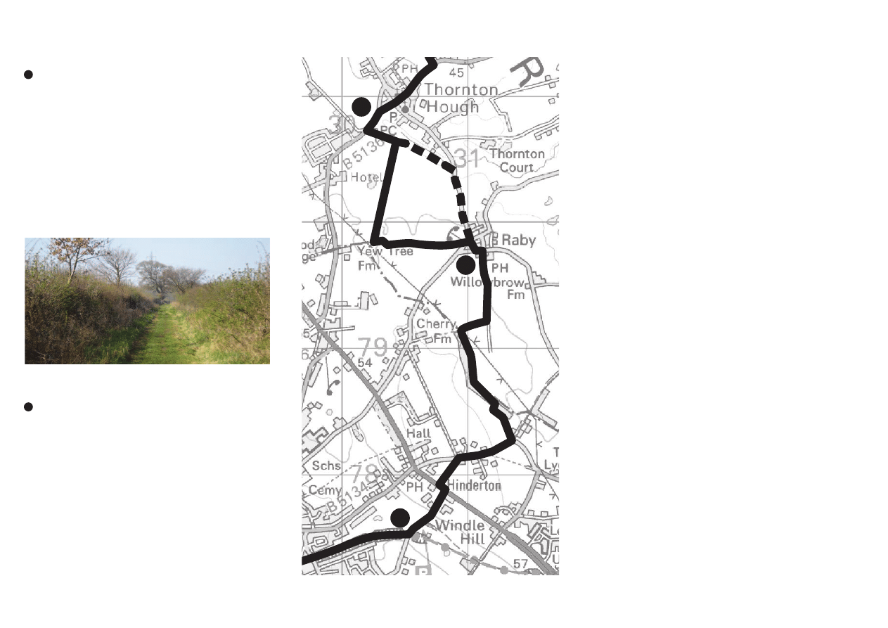
Thornton Hough - Raby
Pass ‘The Store’, ‘The Seven Stars’ Pub, the Village Post
Office and onto The Village Cricket Green. Over the far
side of the green there is a grass path over the stream and
the permissive bridle-route to Raby. You can either turn
left, follow the stream and then the path runs parallel to the
road to Raby Village, or if you turn right, follow the fenced
in path to where the path opens out into a field, go round
the ponds to the public footpath. Turn left onto this lovely
public right of way that leads to Raby Village.
Both of the above routes bring you out by the phone
box. Take the 2nd road on the right and pass The
Wheatsheaf Inn on your left.
Raby - Wirral Country Park, The Wirral Way, Lees
Lane Picnic Site, Neston East
With the Wheatsheaf Inn on your left, go to the end of
the road and continue straight on down the often muddy
farm lane/public right of way. After about a third of a mile
take the footpath on the right then take the first path on the
left which runs through a mature line of trees and a
meadow until you reach ‘Roselea’ on Quarry Road. Turn
right at this point.
Just after School Lane on the right, cross the road and
take the footpath across the field to The Chester High Road.
Cross over, turn left and immediate right into Lees Lane.
Enter the car park on the left into Wirral Country Park and
onto the Wirral Way. This is also part of the Wirral
Circular Trail at this location.
Thornton Hough - Lees Lane, Neston
a
85
a
85
a
Footpath 49 west of Raby
6
7
8
6
7
©
C
ro
wn
co
py
rig
ht
a
nd
d
at
ab
as
e
rig
ht
s 2
01
2
Or
dn
an
ce
S
ur
ve
y
10
00
19
80
3.
Y
ou
a
re
n
ot
p
er
m
itt
ed
to
co
py
, s
ub
-li
ce
ns
e,
d
ist
rib
ut
e
or
se
ll
an
y
of
th
is
da
ta
to
th
ird
p
ar
tie
s i
n
an
y
fo
rm
.

4
Lees Lane Picnic Site, Wirral Country Park - Parkgate
From the Lees Lane picnic area turn right onto the Wirral
Way towards Neston. Follow this until you reach the end of
the track. At the junction with the main road where Bushell
Road becomes Mellock Lane, cross over into Station Road.
The Wirral Way follows Station Road for about half a mile
keeping Stanney Fields Park on your right. Pass under the
railway bridge and past the car park on your left and then turn
immediately left onto the Wirral Way.
Cross over the Millennium Bridge and continue along the
Wirral Way. There are options to visit the Old Quay of
Neston or explore the nearby town centre. When you get
to the car park, turn left to Parkgate Parade.
Parkgate - Gayton
Continue along Parkgate Parade past the Boathouse
restaurant on your left and through the car park and follow
the path with the Dee Estuary on your left. This is an
excellent vantage point for bird-watching, especially at high tide.
Continue along the sea wall with Heswall Golf Course on
your right and eventually you pass a tall beech hedge at the
end of the path, go down the steps, turn right and walk up
Cottage Lane. After the old railway bridge turn right and
enter Wirral Country Park and turn right again under the
old railway bridge and onto the Wirral Way towards
Heswall.
Lees Lane, Neston - Parkgate & onto Gayton
a
272
a
272
Deeside estuary wall footpath
8
9
9
8
©
C
ro
wn
co
py
rig
ht
a
nd
d
at
ab
as
e
rig
ht
s 2
01
2
Or
dn
an
ce
S
ur
ve
y
10
00
19
80
3.
Y
ou
a
re
n
ot
p
er
m
itt
ed
to
co
py
, s
ub
-li
ce
ns
e,
d
ist
rib
ut
e
or
se
ll
an
y
of
th
is
da
ta
to
th
ird
p
ar
tie
s i
n
an
y
fo
rm
.
5
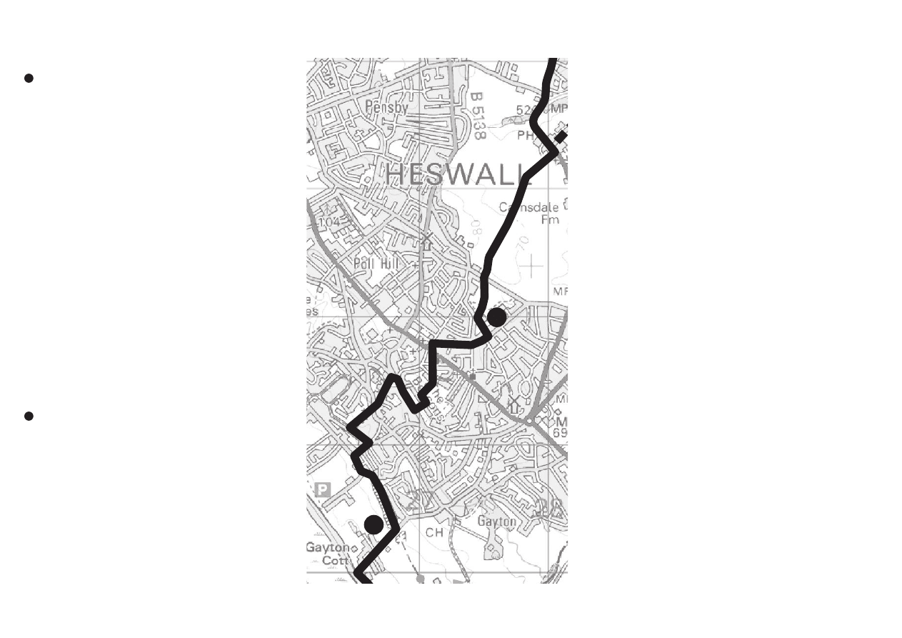
Gayton - Heswall
Enter the Wirral Country Park/Wirral Way/Wirral
Circular Trail from the Cottage Lane entrance and follow
signs for Thurstaston. The Wirral Way comes out onto the
road and continues on to Thurstaston. However this route
turns right into Station Road and then left into Rectory
Lane. After Rectory Close take public footpath 8 up through
the Churchyard of St Peters Church. This comes out in
Lower Heswall village. Go straight over into School Hill
keeping The Black Horse Pub on your left.
Turn right into Brow Lane and then left up the bridle-path
before the cottages. Turn right at the top into Dawstone
Road and continue on the pavement. Just before the next
road on the right which is Wall Rake, turn left up the steep
track following the public footpath signs up onto The
Beacons which is a less well known wooded open space with
views across the Dee Estuary to North Wales. From the
seat at the top of the steps, go diagonally across the open
grassed space and follow the path across The Beacons to
the car park and out into Beacon Lane, and down to where
you can cross Telegraph Road at the light controlled
Pedestrian Crossing. Continue into Briar Drive, forking
right to Boundary Drive where you turn left and then right
into Milner Road to the entrance of Whitfield Common at
the fingerpost and the start of public footpath 62.
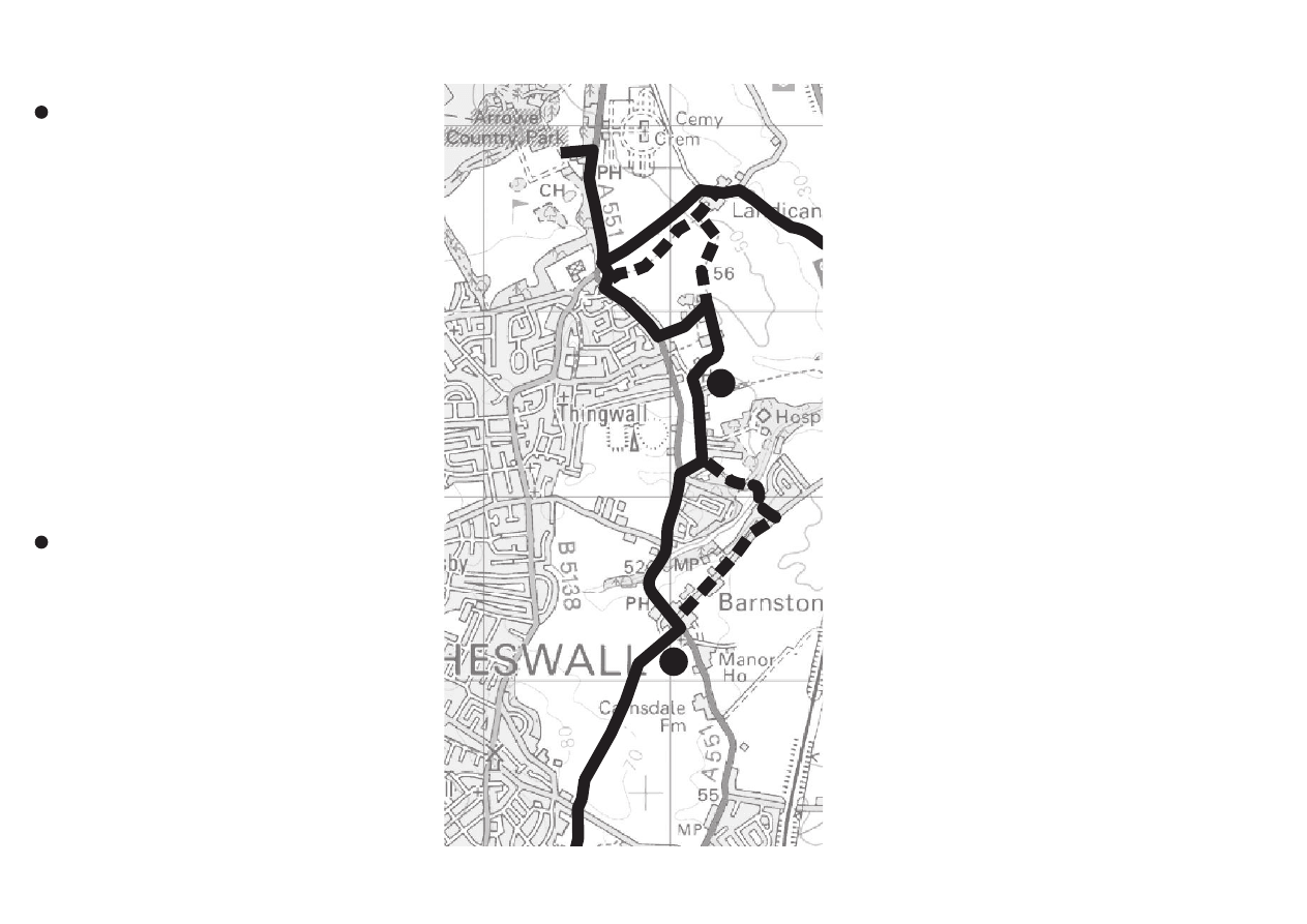
Heswall - Barnston
Follow the path keeping the children’s play area on your
left. Where the path splits into 3, take the path straight on
through the woods, keeping the football pitches on your
right and the tennis courts on your left. Stay on this path
until you come out onto Whitfield Lane. Cross over and
take the footpath to the right of Heswall Primary School
signed for Barnston. Please follow this well signed route
across the fields and over the stiles. This path can be quite
muddy at times, but it does eventually lead you for a short
distance into the Churchyard of Barnston Church. From
the stone stile of the Churchyard, take either path to
Barnston Road.
Gayton - Barnston via Heswall
a
272
a
a
27
a
85
a
77
a
a
272
a
77
a
272
a
27
10
10
11
11
©
C
ro
wn
co
py
rig
ht
a
nd
d
at
ab
as
e
rig
ht
s 2
01
2
Or
dn
an
ce
S
ur
ve
y
10
00
19
80
3.
Y
ou
a
re
n
ot
p
er
m
itt
ed
to
co
py
, s
ub
-li
ce
ns
e,
d
ist
rib
ut
e
or
se
ll
an
y
of
th
is
da
ta
to
th
ird
p
ar
tie
s i
n
an
y
fo
rm
.
6
Barnston - Thingwall
The route turns left to go along the narrow pavement
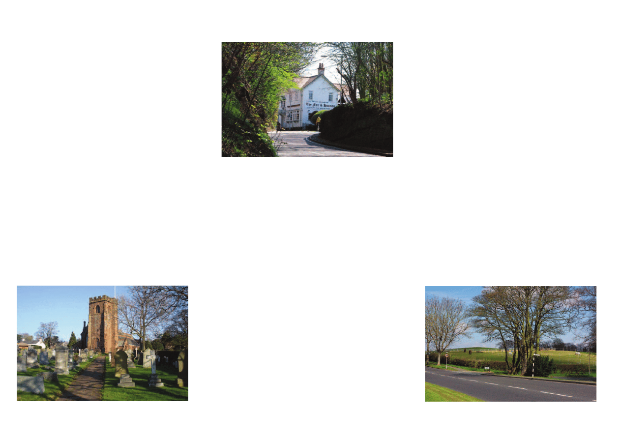
of Barnston Road past the Fox and Hounds Pub. There is
the alternative of crossing the Barnston Road almost
opposite the Church and into Storeton Lane (this is a busy
junction with no pavements for about 150m, so please be
aware). The advantage of this route is that it does take you
along Storeton Lane to just before The Barnstondale
Centre where you take the public footpath down through
the woods, over the river bridge and up to Holmwood
Drive, where you turn right and then pass Murrayfield
Hospital (Spire) on the right.
If you take the route past the Fox and Hounds, continue
down through Barnston Dip, past Gills Lane on the left,
along the wide grass verge on your left. Cross over
Barnston Road at some point and turn right where you
see the old black and white fingerpost into Holmwood
Drive. Follow this road around past the entrance to
Murrayfield Hospital (Spire).
Go past the hospital entrance onto bridleway 15 which
comes out into Lower Thingwall Lane and past the back
of The Bassett Hound Pub.
Thingwall to Arrowe Park
The easy route is to turn right at the end of Lower
Thingwall Lane, back onto Barnston Road which takes
you straight to Thingwall Roundabout.
Or: just before Barnston Road take the public footpath,
through the caravan storage park and follow the footpath
across the fields. This path is very well worn in parts and
can be quite muddy during wet weather periods. When you
get to the Landican Farm, turn left across the fields, passing
the pond on the left. Please note, this route can get very
muddy where the footpath is shared with a large herd of
cows! Follow the path across the fields up the road and
exiting next to Thingwall Roundabout.
Continue along the right hand pavement of Arrowe
Park Road and enter the main entrance of Arrowe Park on
your left at the main light controlled junction.
Barnston - Arrowe Park via Thingwall
a
77
a
272
a
272
a
272
a
77
12
13
12
13
©
C
ro
wn
co
py
rig
ht
a
nd
d
at
ab
as
e
rig
ht
s 2
01
2
Or
dn
an
ce
S
ur
ve
y
10
00
19
80
3.
Y
ou
a
re
n
ot
p
er
m
itt
ed
to
co
py
, s
ub
-li
ce
ns
e,
d
ist
rib
ut
e
or
se
ll
an
y
of
th
is
da
ta
to
th
ird
p
ar
tie
s i
n
an
y
fo
rm
.
7
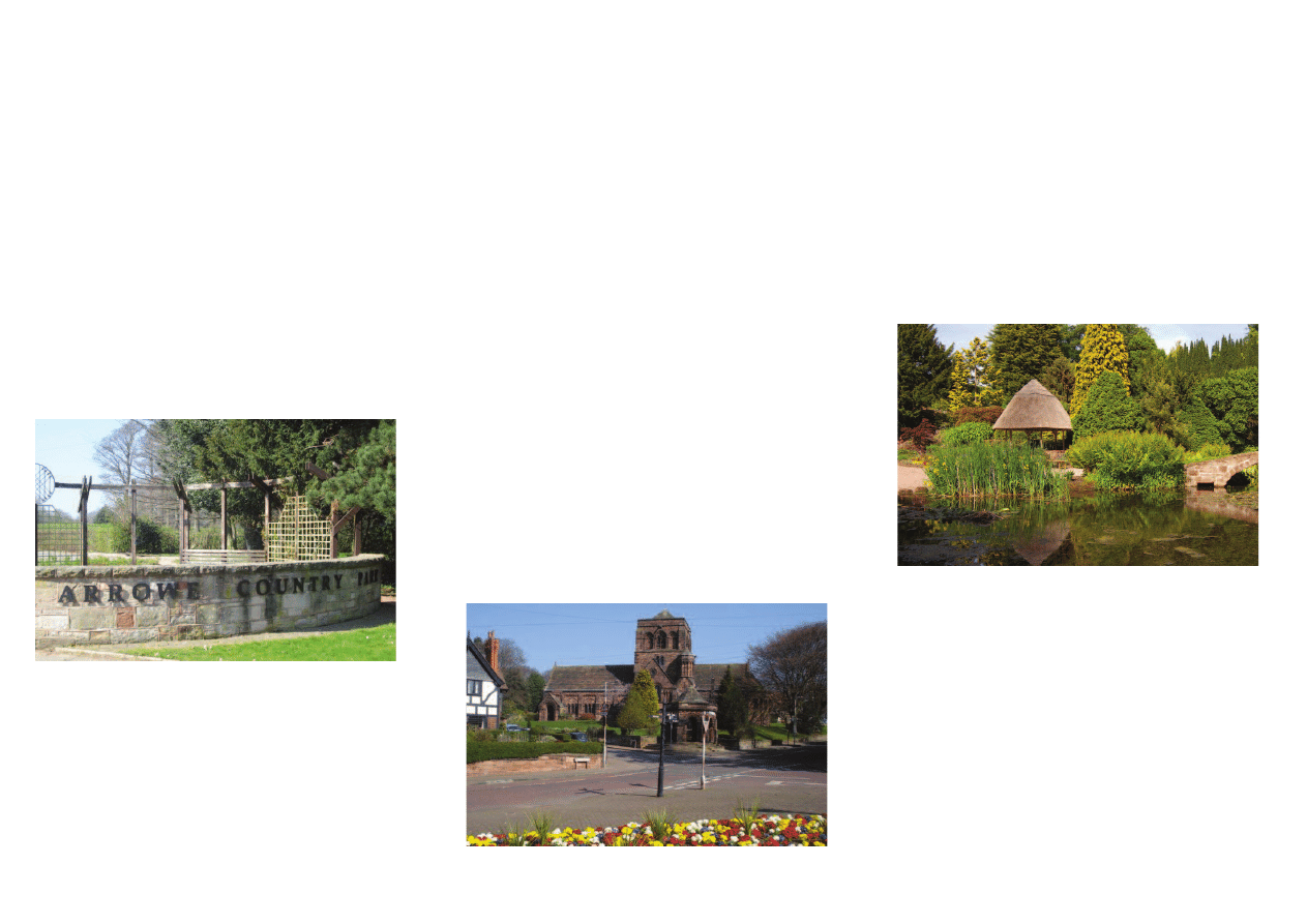
Arrowe Park
Ownership of much of the land in this area was at one
time in the possession of the Trustees of Warrington
Grammar School. However, in 1843 they sold it to John
Ralph Shaw, whose uncle, John Shaw of Liverpool, was
mayor of this town in 1794 and 1800. Like many other
Liverpool merchants Shaw made his money in the slave
trade, and he also operated as a privateer.
Arrowe Hall was built by John R. Shaw in 1835 and
1844. Arrowe Hall and Park were acquired by Lord
Leverhulme in 1908, who subsequently sold the estate to
Birkenhead Corporation in 1929.
From 30 July to 12 August 1929 the famous World
Scout Jamboree was stage at Arrowe Park. Fifty
thousand scouts attended and notwithstanding constant
rain, 300,000 visitors paid for admission.
Landican Village
In 1085 Landican was recorded in the Doomsday Book
as Landechne. The hamlet was a township in
Woodchurch Parish of the Wirral Hundred. It was added
to Birkenhead Civil Parish in 1933. The population stood
at 45 in 1801, 57 in 1851, 71 in 1901 and just 20 in 2001.
Storeton Village
Storeton village and the surrounding area was in the
hands of the Stanley family until 1848 when it was sold
to Sir Thomas Brocklebank owner of the famous
Brocklebank Line of Liverpool. Brocklebank’s mid-
Wirral estate consisted of about 1,171 acres, many
houses and cottages and the famous Storeton quarries.
The Brocklebank family sold the estate in various lots at
a notable auction held in 1911.
Brimstage Village
The main historic feature of Brimstage village is the Hall,
once the residence of the Troutbeck family. It has a tower
attached to it which is the only remains of an ancient
fortified hall in Wirral. Today, Brimstage Hall Courtyard
is composed of a large square of farm buildings tastefully
converted into a series of shops and a cafe.
Thornton Hough
In 1850 the village of Thornton Hough was sold in
portions to Lord Mostyn. Other changes in ownership
then took place that led to the model estate village we see
today being developed in two stages. First, by Joseph
Hirst and secondly by William Hesketh Lever (Later
Lord Leverhulme).
Neston Collieries
The wealthy Stanley family opened the first colliery in
the area, called Ness, it was worked by men from Wales
and other mining areas. Soon after work began at Ness a
second mine was opened in neighbouring Little Neston.
Fierce competition then broke out between the
enterprises, industrial sabotage becoming a regular
feature in the lives of the local miners. Both mines closed
in 1855 but when a railway line reached Neston in 1874
Neston colliery reopened and production then continued
until 1927.
Ness Botanic Gardens
The famous Ness gards were established in 1898 by
Arthur Gilpin Bulley. The family wealth was founded on
importing American cotton. Arthur Bulley’s life,
however, was shaped by his passionate interest in plants.
Over the years he was responsible for introducing a great
number of plant species from abroad. Arthur Bulley’s
daughter, Agnes Lois Bulley (1901-1995) subsequently
donated Ness Gardens to the University of Liverpool.
They are open to the public throughout the year.
Main points of interest
Ness Botanic Gardens
Arrowe Park entrance
Thornton Hough village
8
Mostyn House School and Dr Sir Wilfred Grenfell
Doctor Sir Wilfred Grenfell was born at Mostyn House
School on 28 February 1865. After training as a doctor
and serving as a house surgeon in London he joined the
Royal National Mission for Deep Sea Fishermen. In 1887
he founded the Labrador Medical Mission. Grenfell
became world-famous in 1908 when he survived a
dreadful night on an ice-floe by killing three of his husky
dogs and wrapping himself in their skins. Subsequently
he erected a memorial to these dogs in the Mostyn
House Chapel. Wilfred Grenfell then saw service in the
Great War with the Harvard Surgical Unit.
Heswall
In 1801 the population of Heswall was recorded at 169
and in 1841 it stood at 398. The population then rose
rapidly, mainly due to the construction of two separate
railway lines. These developments induced many wealthy
Liverpool merchants to build their mansions on the
attractive wooded slopes of Heswall, overlooking the
Dee estuary and the mountains of North Wales.
Others soon followed this lead which resulted in the
rapid development of the town until the once separate
villages of Gayton and Pensby became linked through
large-scale housing developments.
Barnston
The Doomsday Book of 1066 states that the village of
Barnston then consisted mainly of a manor house and
two mills. There seems to have been a pub on the site of
the present Fox & Hounds since at least the sixteenth
century although it has changed names several times
over the years.
The Barnstondale Centre
In the 1890s many day-trippers from Liverpool and
Birkenhead made their way to the pleasure grounds in
Barnston Dell where the shady nooks, little glades and
refreshment facilities were appreciated by all these
visitors.
In the first decades of the 20th century further
developments took place, when a giant slide, complete
with coconut mats, swings, slot machines and other
amusement facilities were put in place. The outbreak of
the Second World War in 1939 resulted in the closure of
these leisure facilities.
In 1948 changes took place when it began to be used
as a Holiday Centre. It was subsequently acquired by the
Merseyside Youth Association. Then, in 1988, a generous
benefactor saved the place from a housing development.
The Centre, and its 15 acres of grounds then became
“The Barnstondale Centre’ with the commendable aim of
giving holidays to children from socially deprived inner-
city areas.
The Alwen & Thingwall reservoirs
Early in the 20th century Robert McAlpine & Sons won
the contract to build the Alwen reservoir in Denbighshire.
They also won the contract to build the covered Cross
Hill reservoir at Thingwall, and very substantial parts of
the connecting pipe-line. The first stone of the Alwen dam
was laid on 3rd October 1911, by Alderman Henry Bloor,
Chairman of Birkenhead’s Water Committee.
The Alwen Trail
In 2006 this seven mile long walking trail round
Birkenhead’s Alwen reservoir was formally opened. In
this area this trail links up with the ten mile long Brenig
Trail, the fourteen mile long Two Lakes Trail, and the
one hundred and twenty two mile long Clwydian Way.
Cross Hill, Thingwall
Wirral has a very notable Viking heritage. The two most
outstanding geographical features concerning this
heritage are Thor’s Stone at Thurstaston and the Viking
Parliament that was held on Cross Hill, Thingwall.
Main points of interest
Barnston Dip
St Peters Church, Heswall
Cross Hill, Thingwall
Wyszukiwarka
Podobne podstrony:
Colours&clothes-kl.4, Scenariusze lekcji j. ang SP
COLOURS shapes and materials
Colour Bubbles
colours
2014 colouring pageid 28439 Nieznany (2)
1 Xmas colouring pack1
Colour the insect
Colours Animals Food Numbers Word Search
colourstars
lotto game colours
colourfulcrochet
From local colour to realism and naturalism
COLOURS shapes and materials2
Banneresque Colouring 1 part 2
Beginners Numbers and Colours
Colour the seasons
2 Xmas colouring pack2
colour the fruit
więcej podobnych podstron