088
A. Deposition of the Coonterunah Group in deep water
walor
W V V V W V ^ WWW V V V
bas cii
1ełsic vdcanic
basatt
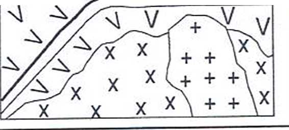
B. Intrusion of Carlindi granitoids causes doming and metamorphism of Coonterunah Group
\
/
i
J;:-
Backarc
Arc/continental margin crust
Magmatic arc Accretionsry
(high temperaturę complex
mełamorphism) (high pressure
Forearc metamorphism)
Mantle lithosphere
Asthenosphere Slab
&
drati
.JLJmM of mantk? wedge
Mantle lithosphere
Plume tectonics
Collision at sites of asthenospheric downweiling
Dispersed magmatism & intraarc sedimentation (high temperaturę metamorphism)
Arc/continental crust
Mantle metasomatism & slab melting
(adakite, high*Mg andesite)
Asthenosphere
Subduction of young, warm _ oceanie
Slab melting ^hospłwre (TTG)
Figurę 4.4: Schematic diagram showing the early evolution of Pilgangoora Belt. Tire entire terrain was then tilted and faulted that the present map view largely reflects the ancient cross-sectior
Continental crust
p^pelaminati^n^
IPs W :( I J. \ ^-
raNnMi
Extension and lithosphere aeneration at sites of asthenospheric upwelling

1
Asthenosphere
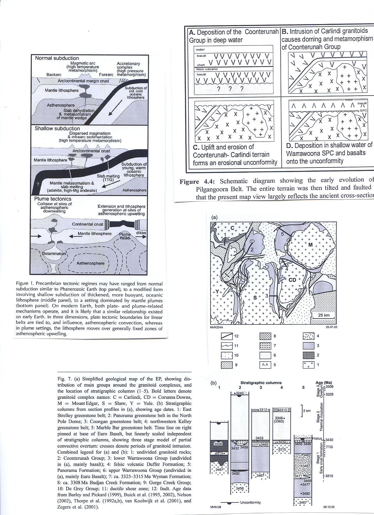
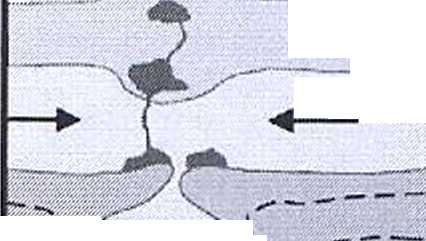
Figurę 1. Precambrian tectonic regimes may have ranged from normal subduction similar to Phanerozoic Earth (top panel), to a modified form involving shallow subduction of thickened, morę buoyant, oceanie lithosphere (middle panel), to a setting dominated by mantle plumes (bottom panel). On modern Earth, both piąte- and plume-related mechanisms operate, and it is likely that a similar relationship existed on early Earth. In three dimensions, piąte tectonic boundaries for linear belts are tied to, and influence, asthenospheric convection, whereas in plume settings, the lithosphere moves over generally fixed zones of asthenospheric upwelling.
Stratigraphic columns 2 3 4
■■warer
SPC
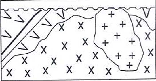
C. Uplift and erosion of Coonterunah- Carlindi terrain fomns an erosional unconformity
D. Deposition in shallow water of Warrawoona SPC and basalts onto the unconformity
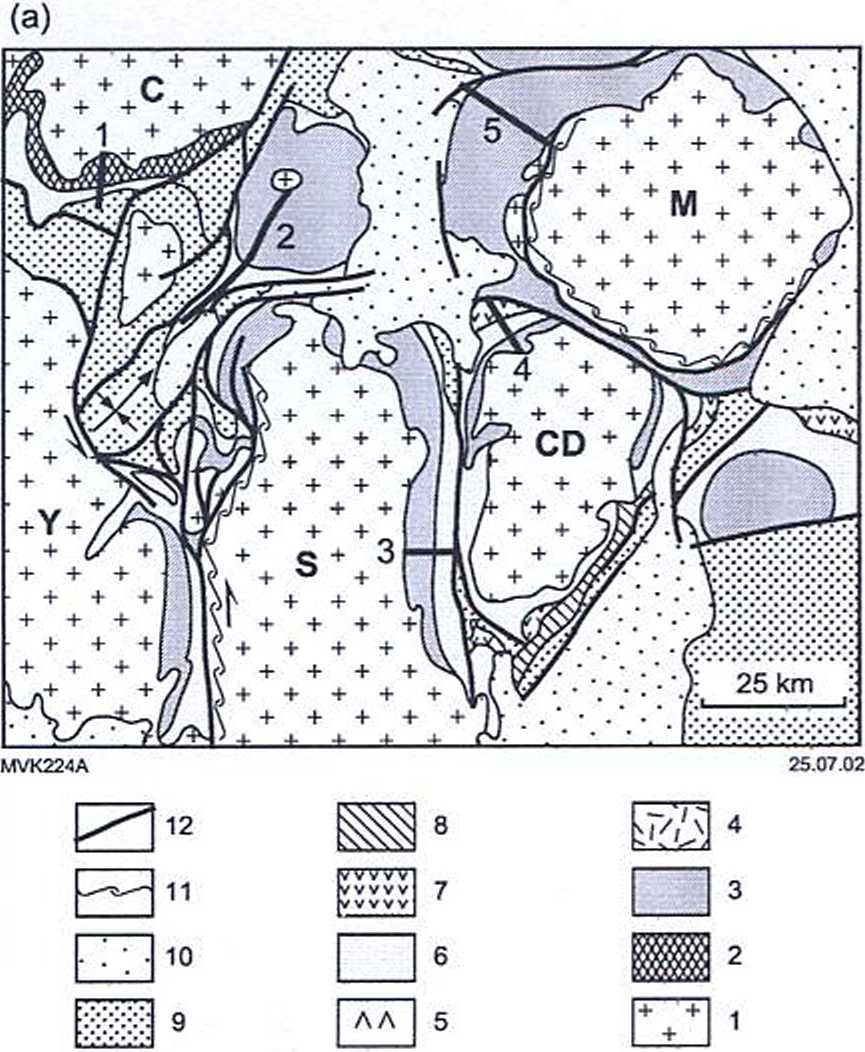
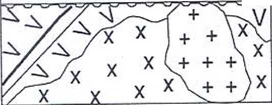
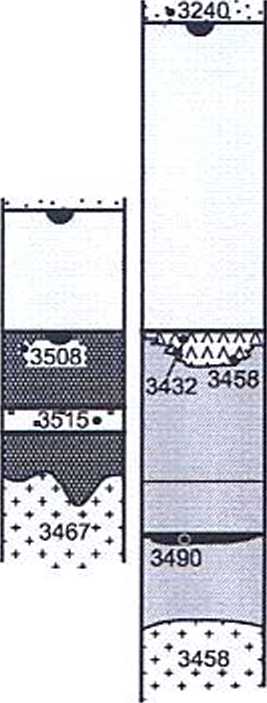
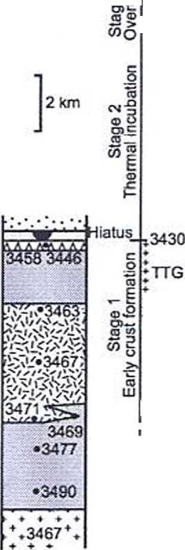
Fig. 7. (a) Simpłificd gcological map of the EP, showing dis-tribution of main groups around the granitoid complcxcs, and the location of stratigraphic columns (l 5). Bold letters denote granitoid complcx names: C = Carlindi, CD = Corunna Downs, M = Mount Edgar, S = Shaw, Y = Yule. (b) Stratigraphic columns from section profiles in (a), showing age dates. I: East Strelley greenstone bclt; 2: Panorama greenstone belt in the North Pole Domc; 3: Coongan greenstone belt; 4: northwestern Kelley greenstone belt; 5: Marblc Bar greenstone belt. Time linę on right pinned at base of Euro Basalt, but linearly scaled independent of stratigraphic columns, showing three stage model of partial convectivc ovcrtum: crosses denote periods of granitoid intrusion. Combined legend for (a) and (b): 1: undivided granitoid rocks; 2: Coonterunah Group; 3: lower Warrawoona Group (undivided in (a), mainly basalt); 4: felsic volcanic Duffer Formation; 5: Panorama Formation; 6: upper Warrawoona Group (undividcd in (a), mainly Euro Basalt); 7: ca. 3325-3315 Ma Wyman Formation; 8: ca. 3308 Ma Budjan Crcck Formation; 9: Gorgc Crcck Group; 10: Dc Grcy Group; 11: ductilc shear zonc; 12: fault. Agc data from Barley and Pickard (1999), Buick et al. (1995, 2002), Nelson (2002), Thorpe et al. (I992a,b), van Koolwijk et al. (2001), and Zcgcrs et al. (2001).
(b)
:v3312r
3433
^■3465
.3467 ♦ *
MVK438
Unconformity
Age (Ma)
°° |r3308 oB
-3325
3346-
(3363)
♦ ♦ ♦ ♦
♦ ♦ ♦ ♦
-3515
06.12.02
Wyszukiwarka
Podobne podstrony:
S5006941 (2) the coins of the Kalisz Group wcre struck (or at least rcmained in circulation) (Surm t
Ensure that your students have a deep and thorough knowledge of the concepts covered in your ec
Moreover, one of the hijras’ favorite in-group insults is the term bhosri vald Vagina-owner’, an epi
GENESIS OF THE GRUDZIĄDZ BASIN IN THE LIGHT OF ITS DEPOSITS AND GLACIAL FORMS Summary The Grudziądz
00344 ?901c63c87335b6f7bf31c8dbbac4a5 348 Prairie & Zimmer ąuality. The purpose of the plans pr
The Nobel Prize in Chemistry 2005"for the development of the metathesis method in organie
S5002141 tio house 187, in Part I. Tha stralght, 11.5 cm long segment of the fitting corresponds in
[3] . McCulloch W.S., Pitts W.: A logical calculus of the ideas immanent in nervous activity. „
490 for evaluation of the synergy effect in the case of ihe fusion of enterprises and intangible res
ownrd by thc lulian Sratc, eicher in acs own narnc ot in «hc rurne of the lulian administration in E
więcej podobnych podstron