W W W . R E F R A C T I O N S . N E T
Tips for the PostGIS Power User
Tips for the PostGIS Power User

W W W . R E F R A C T I O N S . N E T
Topics
Topics
• PostGIS functions
– Geometry constructors / deconstructors
accessors / spatial predicates
– Walk through a few examples.
• DE-9IM
– Fine-tuning spatial predicates
• PostgreSQL
– Table inheritance / partitioning
– Database tuning

W W W . R E F R A C T I O N S . N E T
Introduction
Introduction
• What is PostGIS?
– A PostgreSQL database extension that
"spatially enables" the server back-end to
support the storage of geometric objects
in an object-relational PostgreSQL
database.
– http://postgis.refractions.net/docs/

W W W . R E F R A C T I O N S . N E T
Introduction
Introduction
• Geometry Constructors
– ST_GeomFromText(text)
– ST_GeomFromWKB(bytea)
– Creates a geometry data type in EPSG:
3005 projection
SELECT
ST_GeomFromText( ‘POINT(
1718098
616348
)’,
3005
);
W W W . R E F R A C T I O N S . N E T
SELECT
geom
FROM
gps_point_data
Introduction
Introduction
SELECT geom
FROM gps_point_data
WHERE
time_stamp::date = ‘
2007-09-22
’::date
SELECT geom
FROM gps_point_data
WHERE time_stamp::date = ‘2007-09-22’::date
ORDER
BY
time_stamp
SELECT
ST_MakeLine(gps_points.geom)
FROM
(
SELECT geom
FROM gps_point_data
WHERE time_stamp::date = ‘2007-09-22’::date
ORDER BY time_stamp
) AS gps_points;
SELECT
ST_MakeLine(gps_points.geom)
FROM
(
SELECT
geom
FROM
gps_point_data
WHERE
time_stamp::date = ‘
2007-09-22
’::date
ORDER BY
time_stamp
) AS gps_points;
• Geometry Constructors
W W W . R E F R A C T I O N S . N E T
Introduction
Introduction
• Geometry Constructors
– ST_BuildArea()
SELECT ST_BuildArea(ST_Collect(geom))
FROM ...

W W W . R E F R A C T I O N S . N E T
Introduction
Introduction
• Geometry Accessors / Deconstructors
– ST_StartPoint()
– ST_PointN(geometry, int)
– ST_ExteriorRing(geometry)
SELECT
ST_StartPoint(geom)
FROM
my_lines;
W W W . R E F R A C T I O N S . N E T
Introduction
Introduction
• Geometry Accessors / Deconstructors
Caution:
GROUP
BY
uses a geometry’s bounding box
!
SELECT
ST_StartPoint(geom)
AS
point
FROM
my_lines
SELECT ST_StartPoint(geom) AS point
FROM my_lines
UNION
ALL
SELECT
ST_EndPoint(geom)
AS
point
FROM
my_lines
SELECT
point
FROM
(
SELECT ST_StartPoint(geom) AS point
FROM my_lines
UNION ALL
SELECT ST_EndPoint(geom) AS point
FROM my_lines
)
AS
a
GROUP BY
point
HAVING
count(*) =
4
;
SELECT
point
FROM
(
SELECT
ST_StartPoint(geom)
AS
point
FROM
my_lines
UNION ALL
SELECT
ST_EndPoint(geom)
AS
point
FROM
my_lines)
AS
a
GROUP BY
point
HAVING
count(*) =
4
;
W W W . R E F R A C T I O N S . N E T
Introduction
Introduction
• Geometry Accessors / Deconstructors
– How to explode a MULTI* table
SELECT
ST_GeometryN( geom,
1
)
FROM
my_multilines;
SELECT
generate_series(
1
,
5
);
generate_series
-----------------
1
2
3
4
5
(5 rows)
SELECT
ST_GeometryN(geom,
generate_series(
1
, ST_NumGeometries(geom)))
AS geom
FROM my_multilines
SELECT
ST_GeometryN(geom,
generate_series(
1
, ST_NumGeometries(geom)))
AS
geom
FROM
my_multilines
CREATE
TABLE
my_lines AS
SELECT
geom
FROM
(
SELECT
ST_GeometryN(geom,
generate_series(
1
, ST_NumGeometries(geom)))
AS
geom
FROM
my_multilines
)
AS
foo;

W W W . R E F R A C T I O N S . N E T
Introduction
Introduction
• Geometry Spatial Predicates / Functions
– ST_Intersects()
– ST_Within()
– ST_Touches()
– ST_GeomUnion()
– ST_SymmetricDifference()
– ST_ConvexHull()
– …
W W W . R E F R A C T I O N S . N E T
SELECT
ST_Intersection(a.geom, ST_Buffer(b.geom,
20
))
FROM
streams a, logging b
WHERE
a.geom && ST_Buffer(b.geom,
20
)
AND
ST_Intersects(a.geom, ST_Buffer(b.geom,
20
))
Sample PostGIS Queries
Sample PostGIS Queries
1. Identify the locations where clearcut
logging occurs closer than 20m to a
stream or river.
SELECT
ST_Intersection(a.geom, ST_Buffer(b.geom,
20
))
FROM
streams a, logging b
WHERE
a.geom &&
ST_Buffer
(b.geom,
20
)
AND
ST_Intersects(a.geom, ST_Buffer(b.geom,
20
))
SELECT
ST_Intersection(a.geom, ST_Buffer(b.geom,
20
))
FROM
streams a, logging b
WHERE
a.geom &&
ST_Expand
(b.geom,
20
)
AND
ST_Intersects(a.geom, ST_Buffer(b.geom,
20
))
SELECT
ST_Intersection(a.geom, ST_Buffer(b.geom,
20
))
FROM
streams a, logging b
WHERE
a.geom && ST_Expand(b.geom,
20
)
AND
ST_Intersects(a.geom, ST_Buffer(b.geom, 20))
SELECT
ST_Intersection(a.geom, ST_Buffer(b.geom,
20
))
FROM
streams a, logging b
WHERE
a.geom && ST_Expand(b.geom,
20
)
AND
ST_Distance(a.geom, b.geom) <= 20
SELECT
ST_Intersection(a.geom, ST_Buffer(b.geom,
20
))
FROM
streams a, logging b
WHERE
a.geom && ST_Expand(b.geom,
20
)
AND
ST_Distance(a.geom, b.geom) <=
20
SELECT
ST_Intersection(a.geom, ST_Buffer(b.geom,
20
))
FROM
streams a, logging b
WHERE
ST_DWithin(a.geom, b.geom, 20)
W W W . R E F R A C T I O N S . N E T
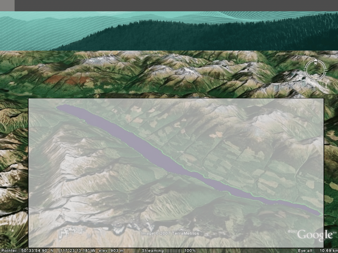
Sample PostGIS Queries
Sample PostGIS Queries
1. What is the average elevation of a
lake digitized in 3D?
SELECT
avg(ST_Z(ST_PointN(ring,
generate_series(
1
, ST_NumPoints(ring))
)
)
FROM
(
SELECT
ST_ExteriorRing(geom)
AS
ring
FROM
lakes
WHERE
lake_id =
1
UNION
ALL
SELECT
ST_InteriorRingN(geom,
generate_series(
1
, ST_NumInteriorRings(geom))
)
AS
ring
FROM
lakes
WHERE
lake_id =
1
)
AS
foo
SELECT avg(ST_Z(ST_PointN(ring,
generate_series(1, ST_NumPoints(ring))
)
)
FROM (
SELECT
ST_ExteriorRing(geom)
AS
ring
FROM
lakes
WHERE
lake_id =
1
UNION ALL
SELECT ST_InteriorRingN(geom,
generate_series(1, ST_NumInteriorRings(geom))
) AS ring
FROM lakes
WHERE lake_id = 1
) AS foo
SELECT avg(ST_Z(ST_PointN(ring,
generate_series(1, ST_NumPoints(ring))
)
)
FROM (
SELECT ST_ExteriorRing(geom) AS ring
FROM lakes
WHERE lake_id = 1
UNION ALL
SELECT
ST_InteriorRingN(geom,
generate_series(
1
, ST_NumInteriorRings(geom))
)
AS
ring
FROM
lakes
WHERE
lake_id =
1
) AS foo
SELECT
avg(ST_Z(ST_PointN(ring,
generate_series(
1
, ST_NumPoints(ring))
)
)
FROM (
SELECT ST_ExteriorRing(geom) AS ring
FROM lakes
WHERE lake_id = 1
UNION ALL
SELECT ST_InteriorRingN(geom,
generate_series(1, ST_NumInteriorRings(geom))
) AS ring
FROM lakes
WHERE lake_id = 1
) AS foo
SELECT
avg(ST_Z(ST_PointN(ring,
generate_series(
1
, ST_NumPoints(ring))
)
)
FROM
(
SELECT
ST_ExteriorRing(geom)
AS
ring
FROM
lakes
WHERE
lake_id =
1
UNION
ALL
SELECT
ST_InteriorRingN(geom,
generate_series(
1
, ST_NumInteriorRings(geom))
)
AS
ring
FROM
lakes
WHERE
lake_id =
1
)
AS
foo
W W W . R E F R A C T I O N S . N E T
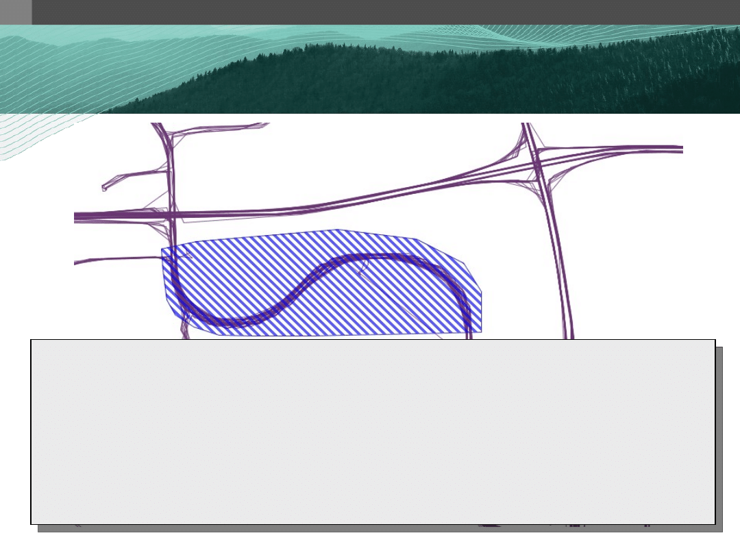
Sample PostGIS Queries
Sample PostGIS Queries
1. Efficiently, union a set of polygons.
SELECT
ST_Union(the_geom)
FROM
...
(takes ~16.7 seconds)
SELECT
ST_Buffer(ST_Collect(geom),
0.0
)
FROM
...
(takes ~4.1 seconds)
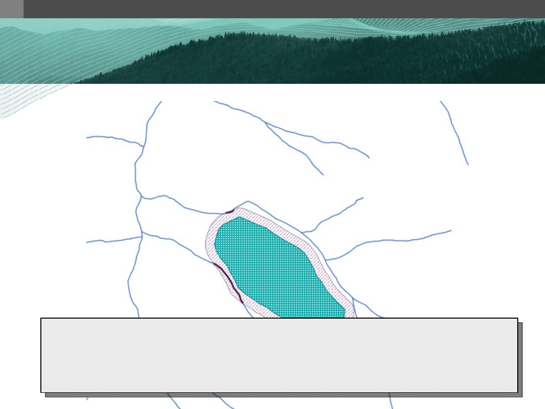
Bighorn Creek
W W W . R E F R A C T I O N S . N E T
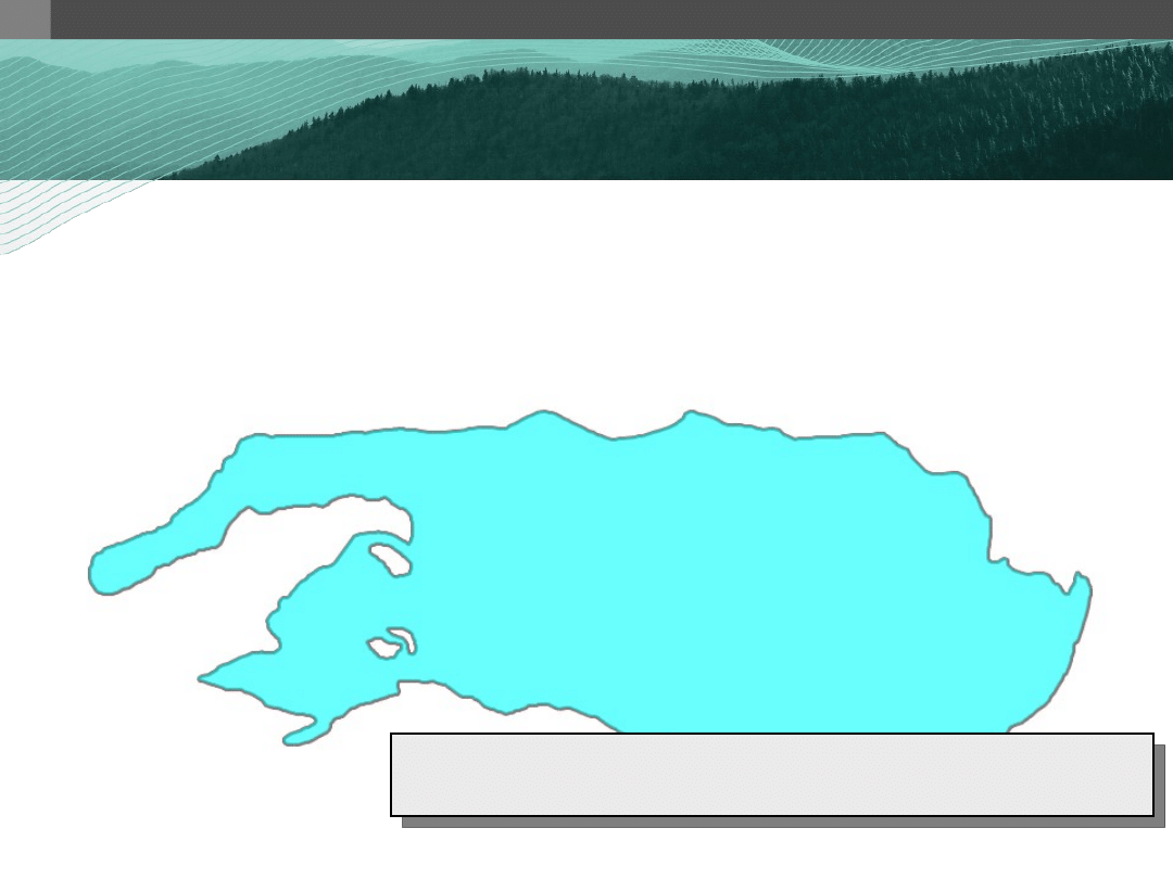
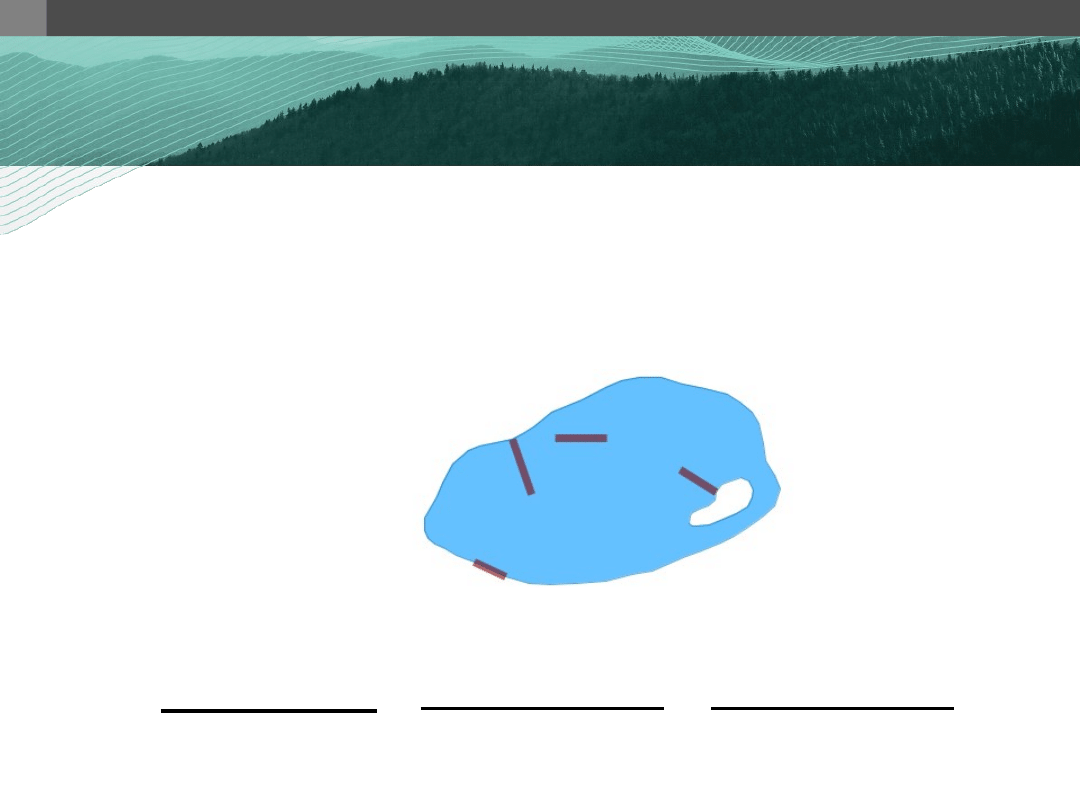
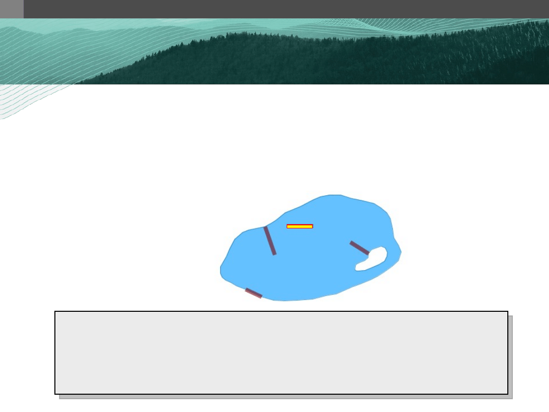
ST_Within? ST_Contains? ST_Touches?
Sample PostGIS Queries
Sample PostGIS Queries
1. Find all docks that are contained
completely within a lake, not
touching a lake bank.
What PostGIS functions would you use?

W W W . R E F R A C T I O N S . N E T
DE-9IM
DE-9IM
The Dimensionally Extended –
The Dimensionally Extended –
Nine Intersection Model
Nine Intersection Model
• Approach
– make pair-wise tests of the intersections
between the Interiors, Boundaries, and
Exteriors of two geometries and to
represent these relationships in an
“intersection” matrix

W W W . R E F R A C T I O N S . N E T
DE-9IM
DE-9IM
The Dimensionally Extended –
The Dimensionally Extended –
Nine Intersection Model
Nine Intersection Model
Possible values:
{T, F, *, 0, 1, 2}
Interior
Boundary
Exterior
Interior
dim( I(a) ∩ I(b) )
dim( I(a) ∩ B(b) )
dim( I(a) ∩ E(b) )
Boundary dim( B(a) ∩ I(b) ) dim( B(a) ∩ B(b) ) dim( B(a) ∩ E(b) )
Exterior
dim( E(a) ∩ I(b) ) dim( E(a) ∩ B(b) ) dim( E(a) ∩ E(b) )
Where:
T == {0,1,2}
F == empty set
* == don’t care
0 == dimensional 0 – point
1 == dimensional 1 – line
2 == dimensional 2 - area
W W W . R E F R A C T I O N S . N E T
DE-9IM
DE-9IM
The Dimensionally Extended –
The Dimensionally Extended –
Nine Intersection Model
Nine Intersection Model
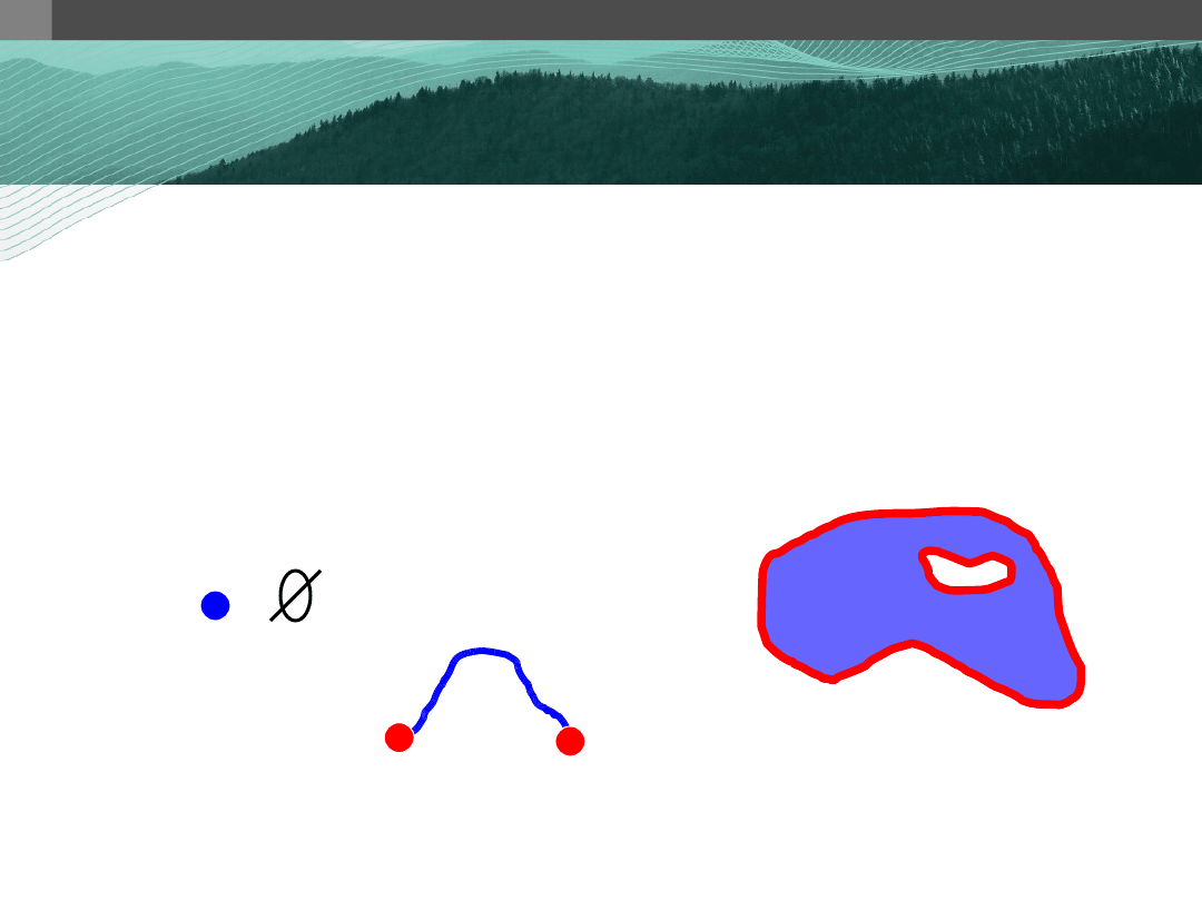
Geometry Topology
• Boundary
– the set of geometries of the next lower
dimension
Point
(dim-0)
Line
(dim-1)
Polygon
(dim-2)
W W W . R E F R A C T I O N S . N E T
DE-9IM
DE-9IM
The Dimensionally Extended –
The Dimensionally Extended –
Nine Intersection Model
Nine Intersection Model
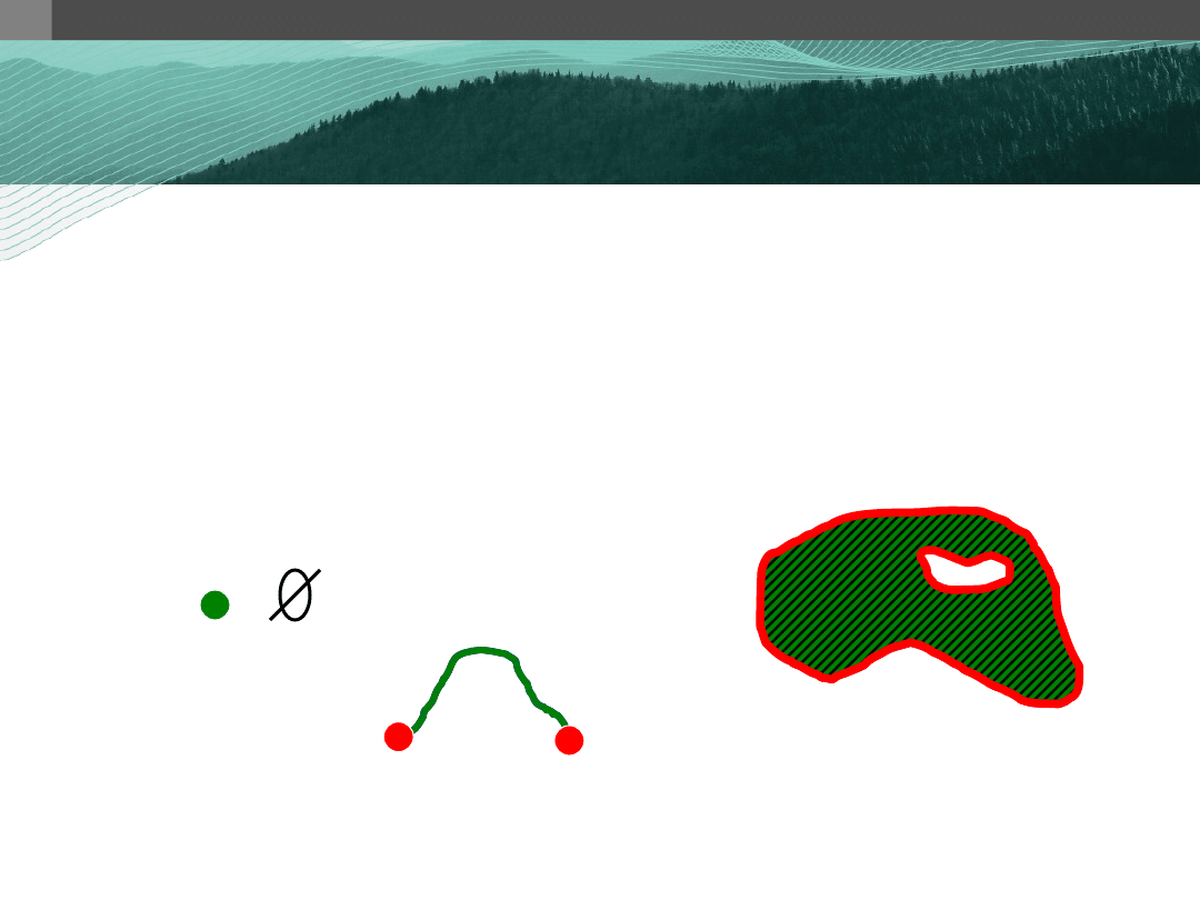
Geometry Topology
• Interior
– the points that are left when the boundary
points are removed
Point
(dim-0)
Line
(dim-1)
Polygon
(dim-2)
W W W . R E F R A C T I O N S . N E T
DE-9IM
DE-9IM
The Dimensionally Extended –
The Dimensionally Extended –
Nine Intersection Model
Nine Intersection Model
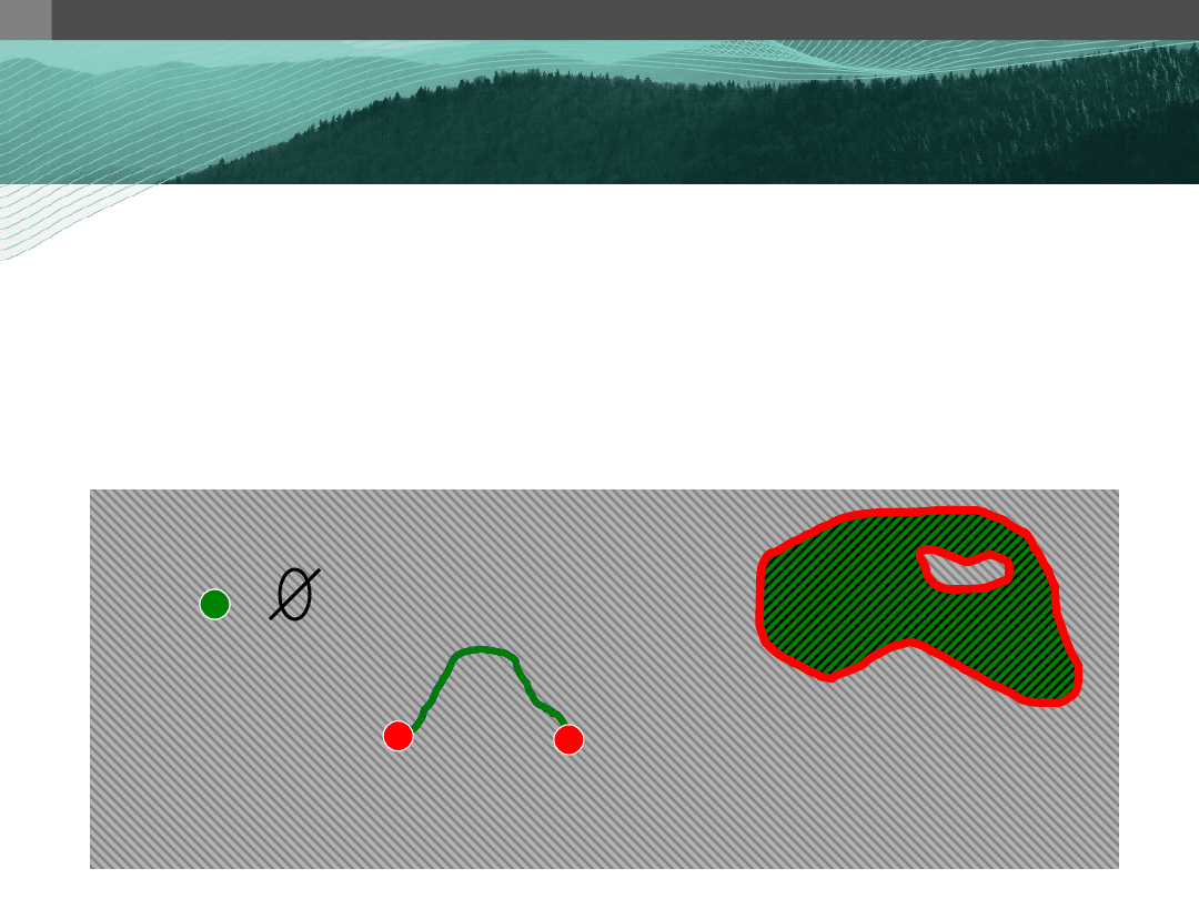
Geometry Topology
• Exterior
– consists of points not in the interior and
boundary
Point
(dim-0)
Line
(dim-1)
Polygon
(dim-2)

W W W . R E F R A C T I O N S . N E T
DE-9IM
DE-9IM
The Dimensionally Extended –
The Dimensionally Extended –
Nine Intersection Model
Nine Intersection Model
Interior Boundary Exterior
Interior
Boundary
Exterior
2
1
2
2
1
2
1
0
1
(a)
(b)
ST_Relate(a, b) = ‘212101212’
W W W . R E F R A C T I O N S . N E T
Sample PostGIS Queries
Sample PostGIS Queries
1. Find all docks that are contained
completely within a lake, not
touching a lake bank.
SELECT
a.id
FROM
docks a, lakes b
WHERE
a.geom && b.geom
AND
ST_Relate(a.geom, b.geom, ‘ ’);
SELECT
a.id
FROM
docks a, lakes b
WHERE
a.geom && b.geom
AND
ST_Relate(a.geom, b.geom, ‘TFF ’);
SELECT
a.id
FROM
docks a, lakes b
WHERE
a.geom && b.geom
AND
ST_Relate(a.geom, b.geom, ‘TFFTFF ’);
SELECT
a.id
FROM
docks a, lakes b
WHERE
a.geom && b.geom
AND
ST_Relate(a.geom, b.geom, ‘TFFTFF212’);
SELECT
a.id
FROM
docks a, lakes b
WHERE
a.geom && b.geom
AND
ST_Relate(a.geom, b.geom, ‘TFFTFF212’);
W W W . R E F R A C T I O N S . N E T
SELECT
a.id
FROM
mylines a, mylines b
WHERE
a.id != b.id
AND
a.geom && b.geom
AND
ST_Relate(a.geom, b.geom, ‘1*1***1**’);
SELECT
a.id, intersection(a.geom, b.geom)
FROM
mylines a, mylines b
WHERE
a.id != b.id
AND
a.geom && b.geom
AND
ST_Relate(a.geom, b.geom, ‘1*1***1**’);
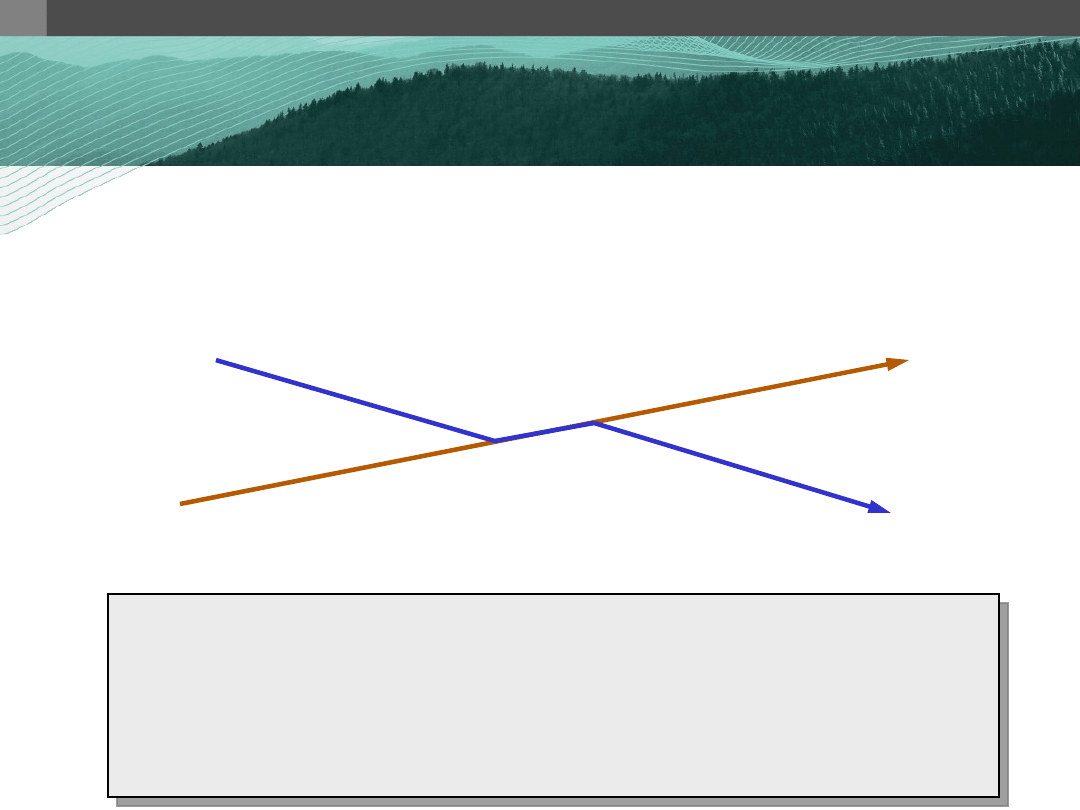
Sample PostGIS Queries
Sample PostGIS Queries
1. Identify linear spatial features that
intersect on a line and not at a point.
W W W . R E F R A C T I O N S . N E T
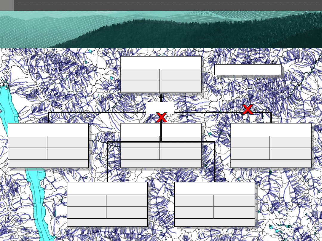
Table Inheritance
Table Inheritance
cities
name
text
population
real
altitude
int
capitals
name
text
population
real
altitude
int
province
text
CREATE TABLE
cities (
name text,
population real,
altitude int
);
CREATE TABLE
capitals (
province text
)
INHERITS
(cities);
inherits
W W W . R E F R A C T I O N S . N E T
Table Inheritance
Table Inheritance
metadata
dataset_name char(4) NOT NULL
validity_date
date NOT NULL
table1
dataset_name char(4) NOT NULL
validity_date
date NOT NULL
attr1
int
attr2
geometry
table2
dataset_name char(4) NOT NULL
validity_date
date NOT NULL
attr1
int
attr2
text
attr2
geometry
…
dat…
ch...
val…
da…
…
int
inherits
W W W . R E F R A C T I O N S . N E T
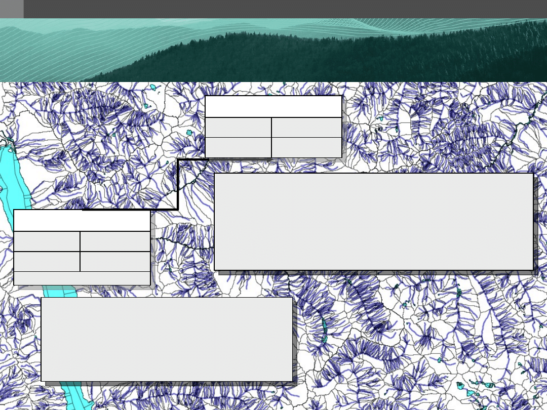
Table Partitioning
Table Partitioning
hydro_edges
code
smallint
the_geom geometry
hol_edges
code
smallint
the_geom geometry
admin_edges
code
smallint
the_geom geometry
cwb_edges
code
smallint
the_geom geometry
new_hol_edges
code
smallint
the_geom geometry
new_admin_edges
code
smallint
the_geom geometry
inherits
(16 million tuples)
code check constraints
code check constraints
code check constraints
code check constraints
code check constraints
Empty table
W W W . R E F R A C T I O N S . N E T
Table Partitioning
Table Partitioning
CREATE TABLE
hydro_edges (
)
INHERITS
cwb_edges;
ALTER TABLE
hydro_edges
ADD CONSTRAINT
code_check
CHECK
(code = ...);
hydro_edges
code
smallint
the_geom geometry
cwb_edges
code
smallint
the_geom geometry
code check constraints
-- ADD Rules to parent table
CREATE RULE
insert_hydro
AS
ON INSERT TO
cwb_edges
WHERE
code = ...
DO INSTEAD
INSERT INTO
hydro_edges (code, geom)
VALUES
(
NEW
.code,
NEW
.geom);

W W W . R E F R A C T I O N S . N E T
PostgreSQL Tuning
PostgreSQL Tuning
• The biggest bottleneck in a spatial
database is I/O
• When setting up a server, invest in a:
– great
file system
• RAID 5 – good for web servers, not spatial DBs
• Recommend RAID 1/0
– good
memory
– adequate
CPU(s)

W W W . R E F R A C T I O N S . N E T
PostgreSQL Tuning
PostgreSQL Tuning
• postgresql.conf
– Startup
• checkpoint_segment_size
– # of WAL files – 16MB each
– Default: 3
– Set to at least 10 or 30 for databases with heavy
write activity or more for large database loads
– Possibly store the xlog on a separate disk device
• shared_buffers
– Default: ~32MB
– About 1/3 to 3/4 of available RAM

W W W . R E F R A C T I O N S . N E T
PostgreSQL Tuning
PostgreSQL Tuning
• postgresql.conf
– Startup
• constraint_exclusion
– Default: “off”
– Set to “on” to ensure the query planner will
optimize as desired.

W W W . R E F R A C T I O N S . N E T
PostgreSQL Tuning
PostgreSQL Tuning
• postgresql.conf
– Runtime
• work_mem
– Memory used for sort operations and complex queries
– Default: 1MB
– Adjust up for large dbs, complex queries, lots of RAM
– Adjust down for many concurrent users or low RAM

W W W . R E F R A C T I O N S . N E T
PostgreSQL Tuning
PostgreSQL Tuning
• postgresql.conf
– Runtime
• maintainence_work_mem
– Memory used for VACUUM, CREATE INDEX, etc.
– Default:16MB
– Generally too low – ties up I/O, locks objects while
swapping memory.
– Recommend 32MB to 256MB on production servers
with lots of RAM, but depends on number of
concurrent users.

W W W . R E F R A C T I O N S . N E T
PostgreSQL Tuning
PostgreSQL Tuning
• postgresql.conf
– Runtime
• On development systems with lots of RAM and
few developers…
SET
work_mem
TO
1200000;
SET
maintainence_work_mem
TO
1200000;

W W W . R E F R A C T I O N S . N E T
PostgreSQL Tuning
PostgreSQL Tuning
• postgresql.conf
– Runtime
• client_min_messages
– Useful when writing PL/Pgsql functions.
SET
client_min_messages to
DEBUG
;
CREATE
FUNCTION
my_function ()
RETURNS
TEXT
AS
$BODY$
BEGIN
...
RAISE
DEBUG
‘myvar: %’ var;
...

W W W . R E F R A C T I O N S . N E T
Performance Tips
Performance Tips
• Spatial function calls can be expensive.
Be efficient in their use - avoid
unnecessary/duplicate function calls.
– Use St_Expand where appropriate
– Use one relate call instead of 2 or 3 other
spatial calls.
– Use St_Distance()==0 instead of
intersects() on large geometries
– Avoid St_Buffer() unless you need a
buffered geometry

W W W . R E F R A C T I O N S . N E T
Performance Tips
Performance Tips
• Partition your data into Most
Frequently Used (MFU) and Least
Frequently Used (LFU).

Questions

W W W . R E F R A C T I O N S . N E T
Appendex A
Appendex A
// PostGIS and JTS
Class.forName(
“org.postgresql.Driver”
);
Connection conn =
DriverManager.getConnection(
“jdbc:postgresql://...”
);
WKBReader wkbReader =
new
WKBReader();
WKBWriter wkbWriter =
new
WKBWriter();
String query =
“SELECT the_geom FROM my_spatial_table
WHERE the_geom && ST_GeomFromWKB(?, 3005)”
);
PreparedStatement pstmt = conn.prepareStatement(query);
pstmt.setBytes(1, wkbWriter.write(myJTSPolygon);
ResultSet rs = pstmt.executeQuery();
while(rs.next) {
Geometry g = wkbReader.read(WKBReader.hexToBytes(
rs.getString(1)));
...
// Do stuff with Geometry
}

W W W . R E F R A C T I O N S . N E T
Appendex B
Appendex B
Wyszukiwarka
Podobne podstrony:
Body Language Secrets For Power and Love
PBO TD04 F04 Voyage report for power engineering?partment
WIRING DIAGRAMS FOR POWER SUPPLIES SECTION 3 7
Signal Limiter for Power Amplifiers
Fight for power between Horus and Seth
(ebook english) David Irving Churchill s War Struggle for Power Part 4 (2003)
The Scorpion King 4 Quest for Power
[US 2005] 6864611 Synchronous generator for service in wind power plants, as well as a wind power
Going 3D Survival Guide for 2D CAD Users
Battery Inverter For Modularly Structured Pv Power Supply Systems
Innovative Solutions In Power Electronics For Variable Speed Wind Turbines
Cambridge University Press A Guide to MATLAB for Beginners and Experienced Users J5MINFIO6YPPDR6C36
Adaptive fuzzy control for uninterruptible power supply with three phase PWM inverter
Control and Power Supply for Resistance Spot Welding (RSW)
A Composite Pwm Method Of Three Phase Voltage Source Inverter For High Power Applications
Strength and Power Training for Youth Soccer Players
Time Series Models For Reliability Evaluation Of Power Systems Including Wind Energy
więcej podobnych podstron