QuickBird Satellite Imagery
January 2, 2005
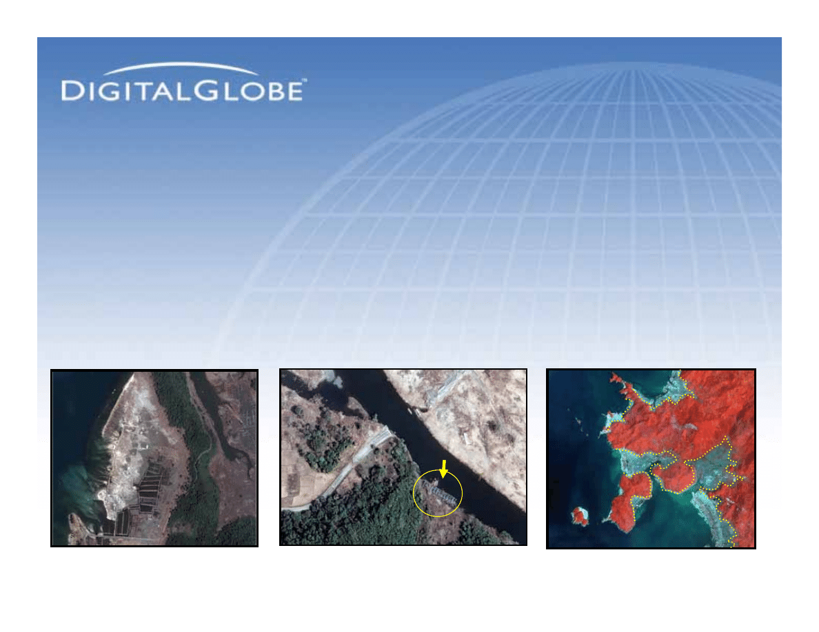
Tsunami Aftermath: Near Banda Aceh,
Indonesia
Tsunami Aftermath: Near Banda Aceh,
Indonesia
40km SSW of Band Aceh
2 January 2005
Destroyed Bridge and Road
Near-Infrared Image of Eroded
Coastline (50km SW of Banda
Aceh)
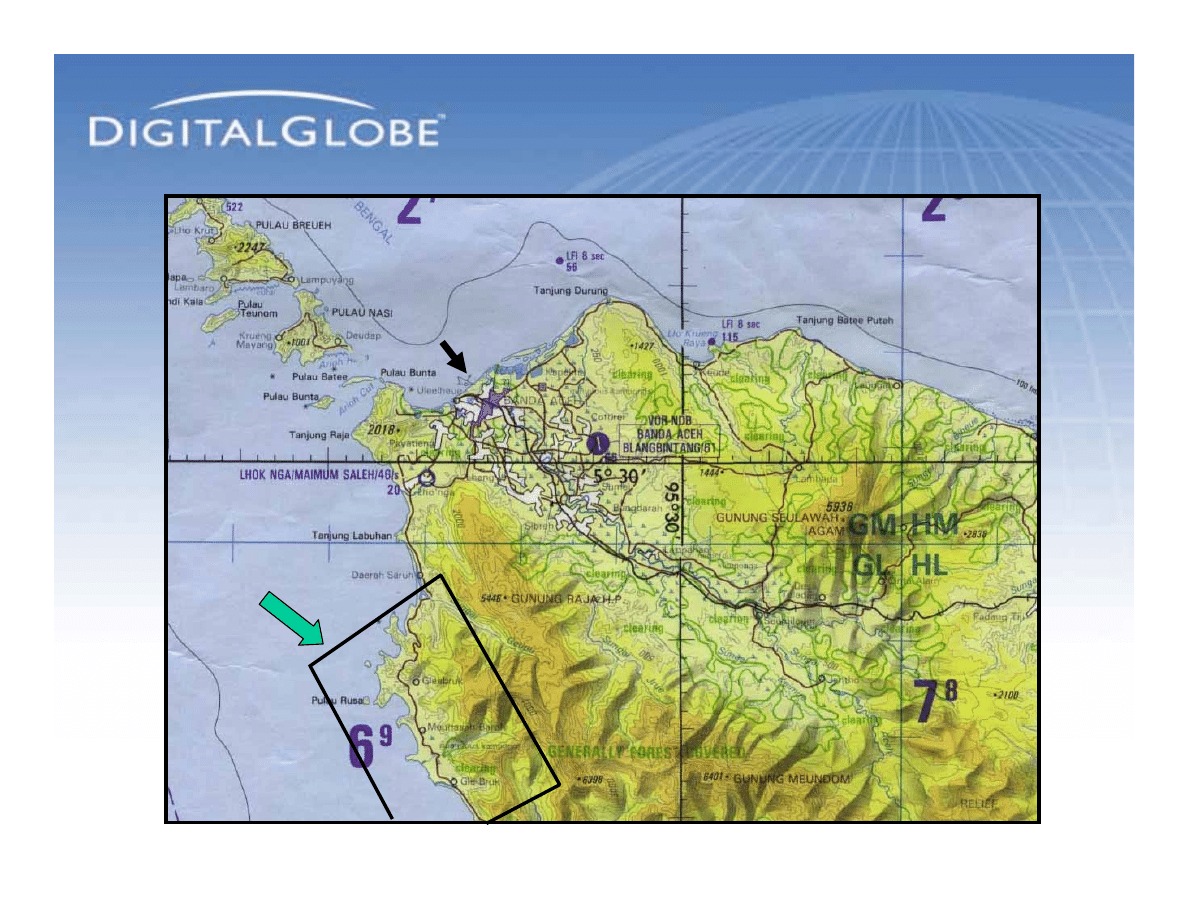
Extent of Coverage:
January 2, 2005
Extent of Coverage:
January 2, 2005
Approximate
Area of QuickBird
Image (January 2, 2005)
Banda Aceh
Catalog ID:
10100100037C9E01
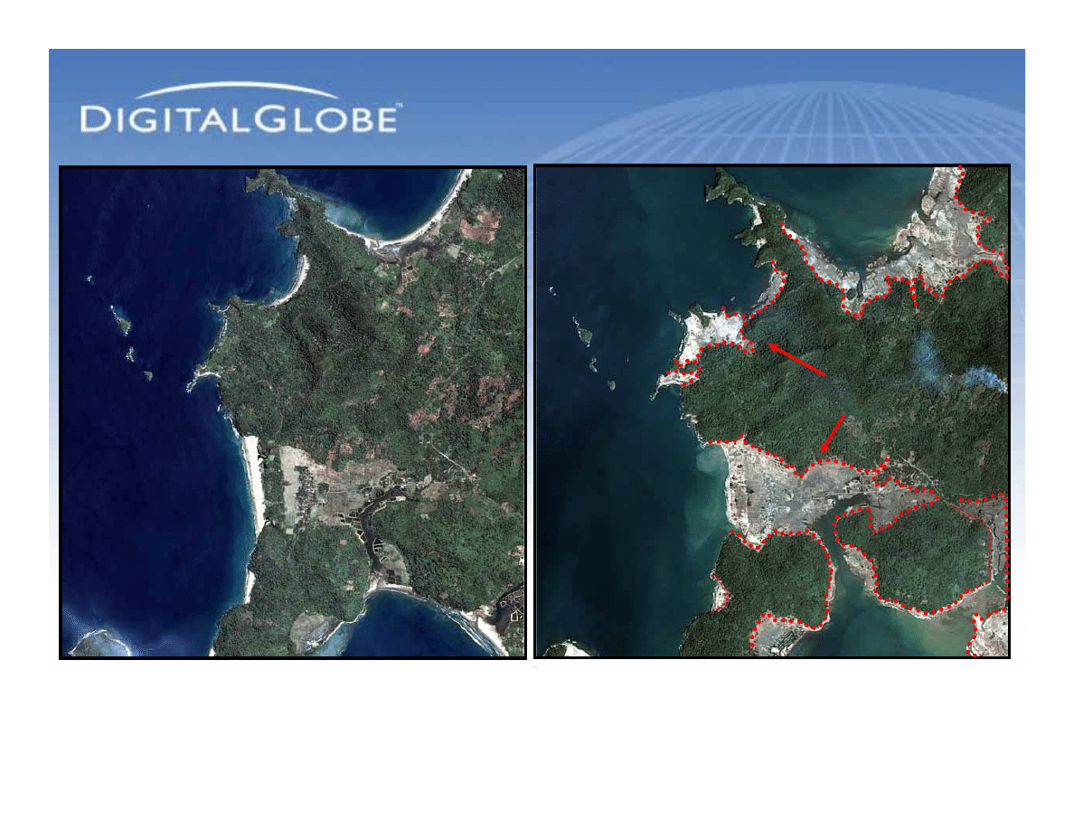
A Changed Coastline
A Changed Coastline
Before the Tsunami
Before the Tsunami
After the Tsunami
After the Tsunami
QuickBird Natural Color Image
April 12, 2004
QuickBird Natural Color Image
January 2, 2005
Pulau Rusa
Pulau Rusa
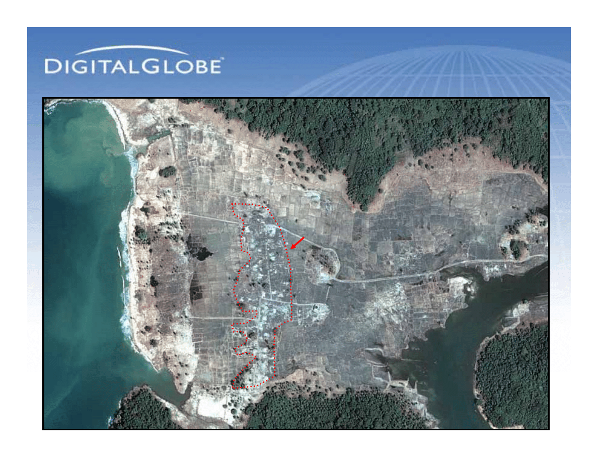
Approximate
Area of Main Tsunami Damage
Gleebruk
Indonesia
Gleebruk
Indonesia
Catalog ID:
10100100037C9E01
Catalog ID:
1010010002DA4C05
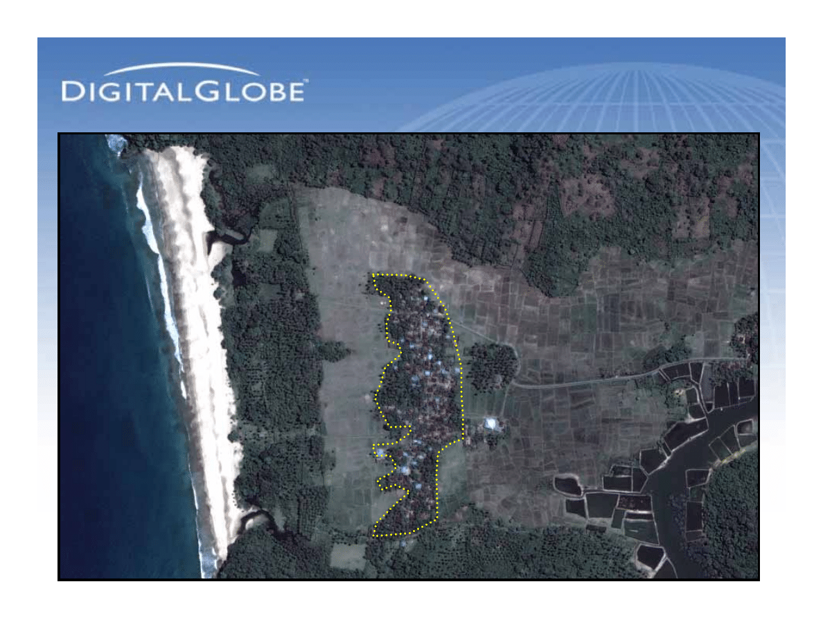
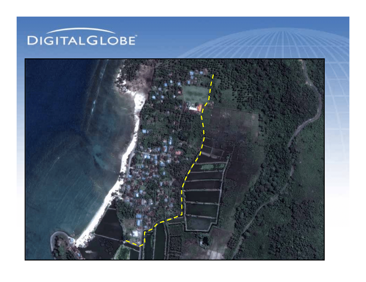
Town Along the Coast:
Before
Town Along the Coast:
Before
Village
Village
QuickBird 60-cm Natural Color Image
April 12, 2004
Fields
&
Crops
Location: 5-17-35N
95-13-08E
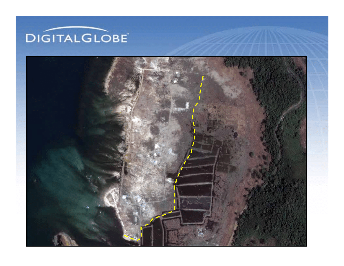
Town Along the Coast:
After the Tsunami
Town Along the Coast:
After the Tsunami
Village
QuickBird 60-cm Natural Color Image
April 12, 2004
QuickBird 60-cm Natural Color Image
January 2, 2005
Destroyed
Village
Destroyed
Village
Beaches
and
Coastline
Destroyed
Beaches
and
Coastline
Destroyed
Trees
& Fields
Destroyed
Trees
& Fields
Destroyed
Fields, Crops
Destroyed
Fields, Crops
Destroyed
Location: 5-17-35N
95-13-08E
Town Along the Coast:
Before
Town Along the Coast:
Before
QuickBird 60-cm Natural Color Image
April 12, 2004
Seaside
Village
Seaside
Village
Location: 5-21-30N
95-14-26E
Town Along the Coast:
After the Tsunami
Town Along the Coast:
After the Tsunami
QuickBird 60-cm Natural Color Image
April 12, 2004
Destroyed
Fields, Crops
Destroyed
Fields, Crops
QuickBird 60-cm Natural Color Image
January 2, 2005
Completely
Destroyed
Village
Completely
Destroyed
Village
Location: 5-21-30N
95-14-26E
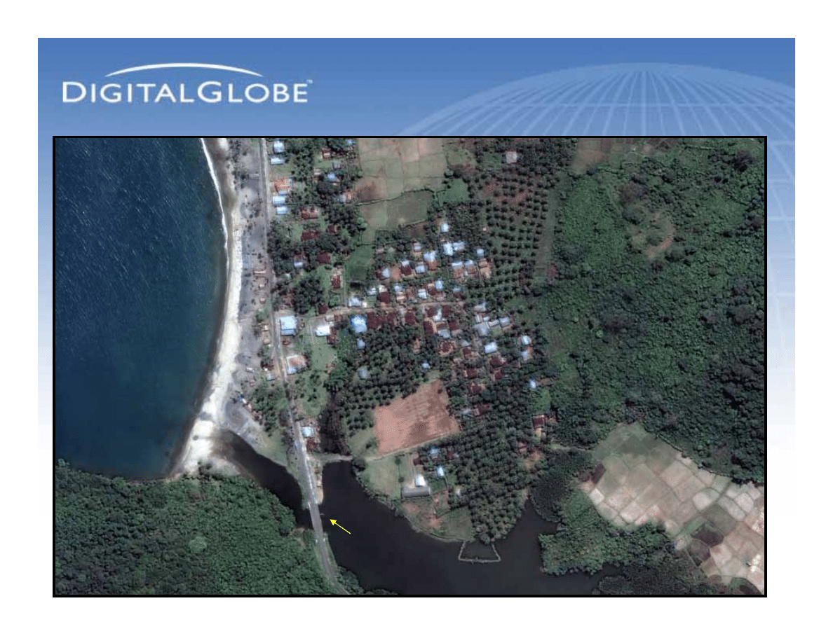
Roads and Bridges:
Before the Tsunami
Roads and Bridges:
Before the Tsunami
QuickBird 60-cm Natural Color Image
April 12, 2004
Bridge
Location: 5-21-53N
95-14-41E
Village
Roads and Bridges:
After the Tsunami
Roads and Bridges:
After the Tsunami
QuickBird 60-cm Natural Color Image
January 2, 2005
Location: 5-21-53N
95-14-41E
Destroyed
Village
Destroyed
Village
Piles of Trees
and Debris
Missing
Bridge Span
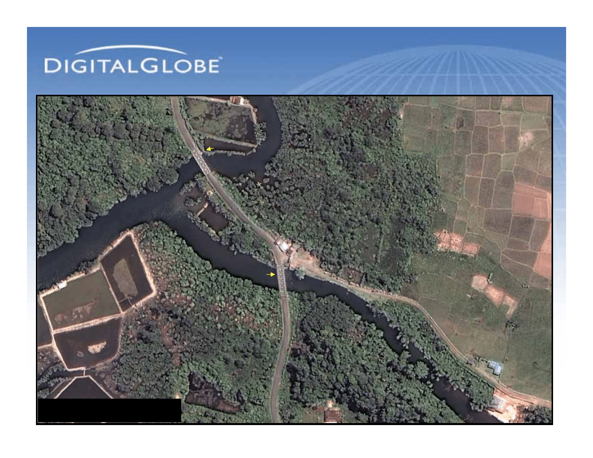
Roads and Bridges:
Before the Tsunami
Roads and Bridges:
Before the Tsunami
QuickBird 60-cm Natural Color Image
April 12, 2004
Bridge
Span
Bridge
Span
Location:
5-17-05N
95-14-40E
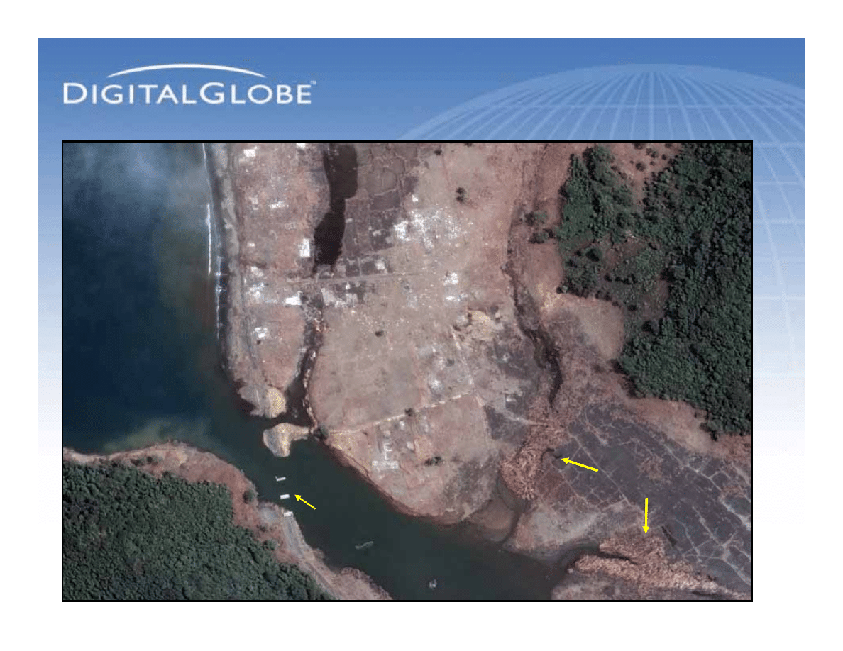
Broken Roads, Destroyed
Bridges: After the Tsunami
Broken Roads, Destroyed
Bridges: After the Tsunami
QuickBird 60-cm Natural Color Image
January 2, 2005
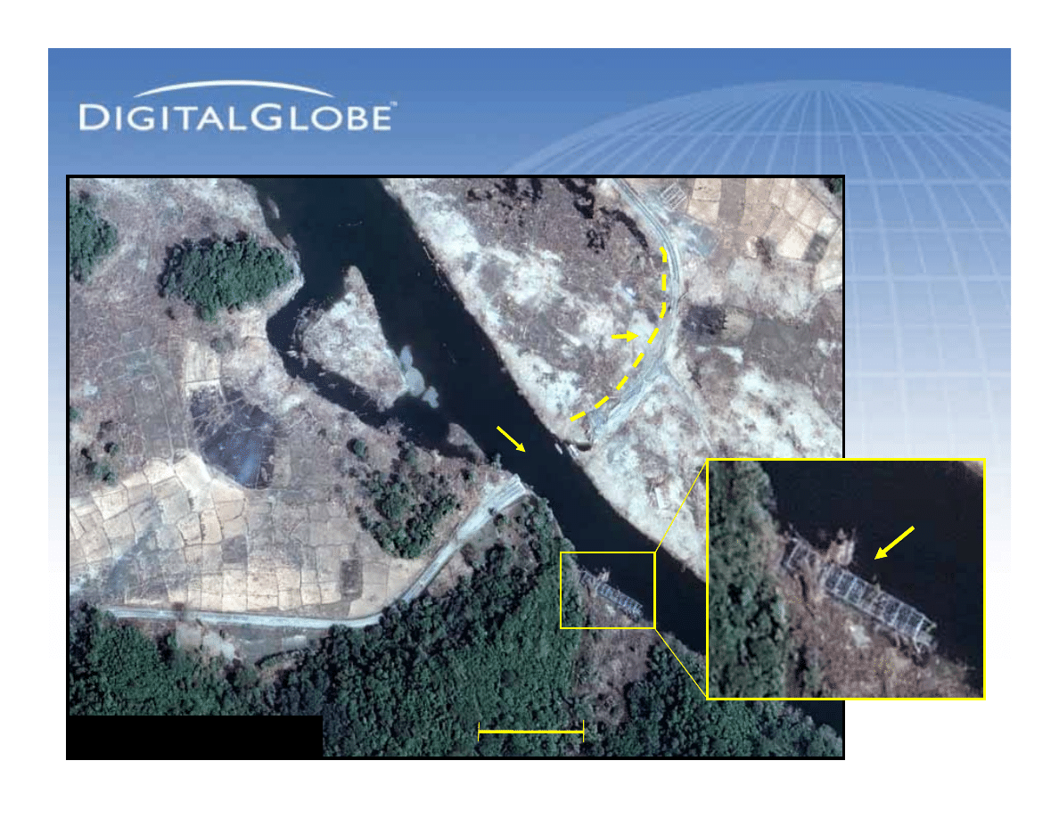
Washed Out Road and
Bridge Spans
Washed Out Road and
Bridge Spans
Missing Bridge Span
(seen under piles of debris)
Missing Bridge Span
(seen under piles of debris)
Missing Bridge Span
(under debris)
Missing Bridge Span
(under debris)
1
1
2
2
Meters
0
300
Location:
5-17-05N
95-14-40E
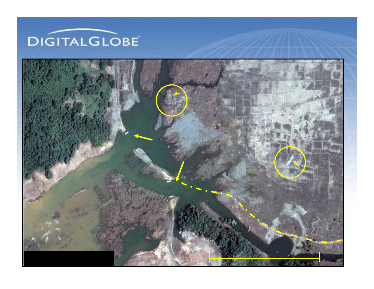
Broken Roads, Destroyed
Bridges: After the Tsunami
Broken Roads, Destroyed
Bridges: After the Tsunami
Torn-away
Bridge Span
Torn-away
Bridge Span
Piles of
Debris, Logs
Piles of
Debris, Logs
Missing
Bridge Span
Washed
Out Road
Washed
Out Road
QuickBird 60-cm Natural Color Image
January 2, 2005
0
0
100
meters
Location
5-22-27N
95-15-26E
Wyszukiwarka
Podobne podstrony:
Damage Control Plan
DAMAGE CONRTOL PLAN, AM SZCZECIN, ratownictwo morskie
BoschAutoParts com DamagedO2SensorFaces
Legendary Lives NPC Damage Trackers
Potencjalne tsunami na Atlantyku zagraża Florydzie, W ஜ DZIEJE ZIEMI I ŚWIATA, ●txt RZECZY DZIWNE
tsunami
HAARP PIRWSZE PROBY NA ZIEMI TRZESIENIA ZIEMI TSUNAMI
Damage control plan ORLA
Część Antarktydy oderwała się po uderzeniu japońskiego tsunami , Część Antarktydy oderwała się po ud
W Kornwalii doszło do małego tsunami i zadziwiającego efektu elektrostatycznego , W Kornwalii doszło
Damage Control Booklet CV for S Nieznany
INDEX brain damage
DAMAGE CONTROL PLAN
Zagrożenia tsunami i trzęsienia ziemi
Tsunami w Japonii to dopiero początek, W ஜ DZIEJE ZIEMI I ŚWIATA, ●txt RZECZY DZIWNE
Oral resveratrol reduces neuronal damage
Tsunami
więcej podobnych podstron