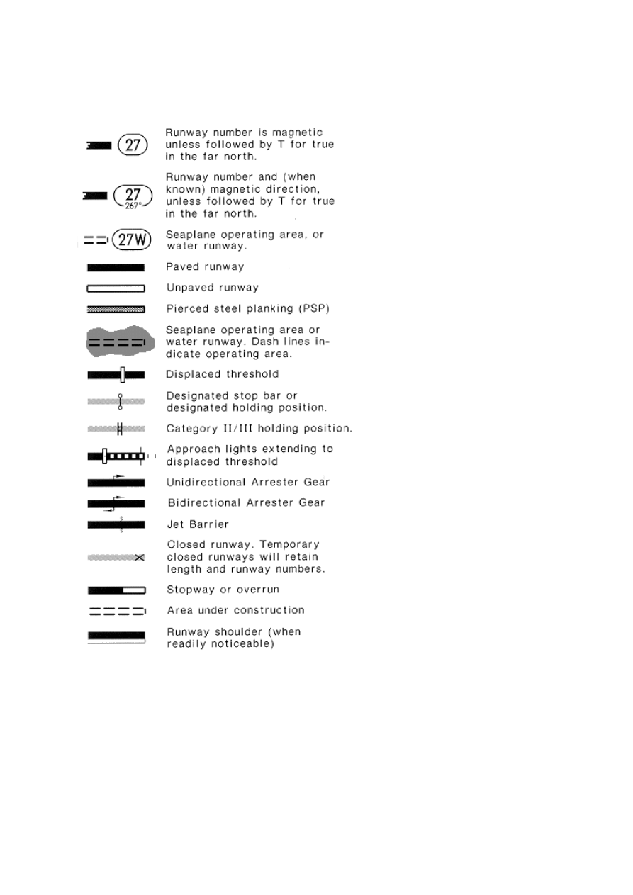
Approach Chart - Airport Plan View
SYMBOLS
Physical feature symbols used on the airport chart are illustrated below.

No differentiation between types of surface for ramps, taxiways, closed runways, closed taxiways,
runway shoulders, and areas other than runways. Stopways and overruns are shown regardless of
surface, with the length, when known. Stopway and overrun lengths are not included in runway
lengths.
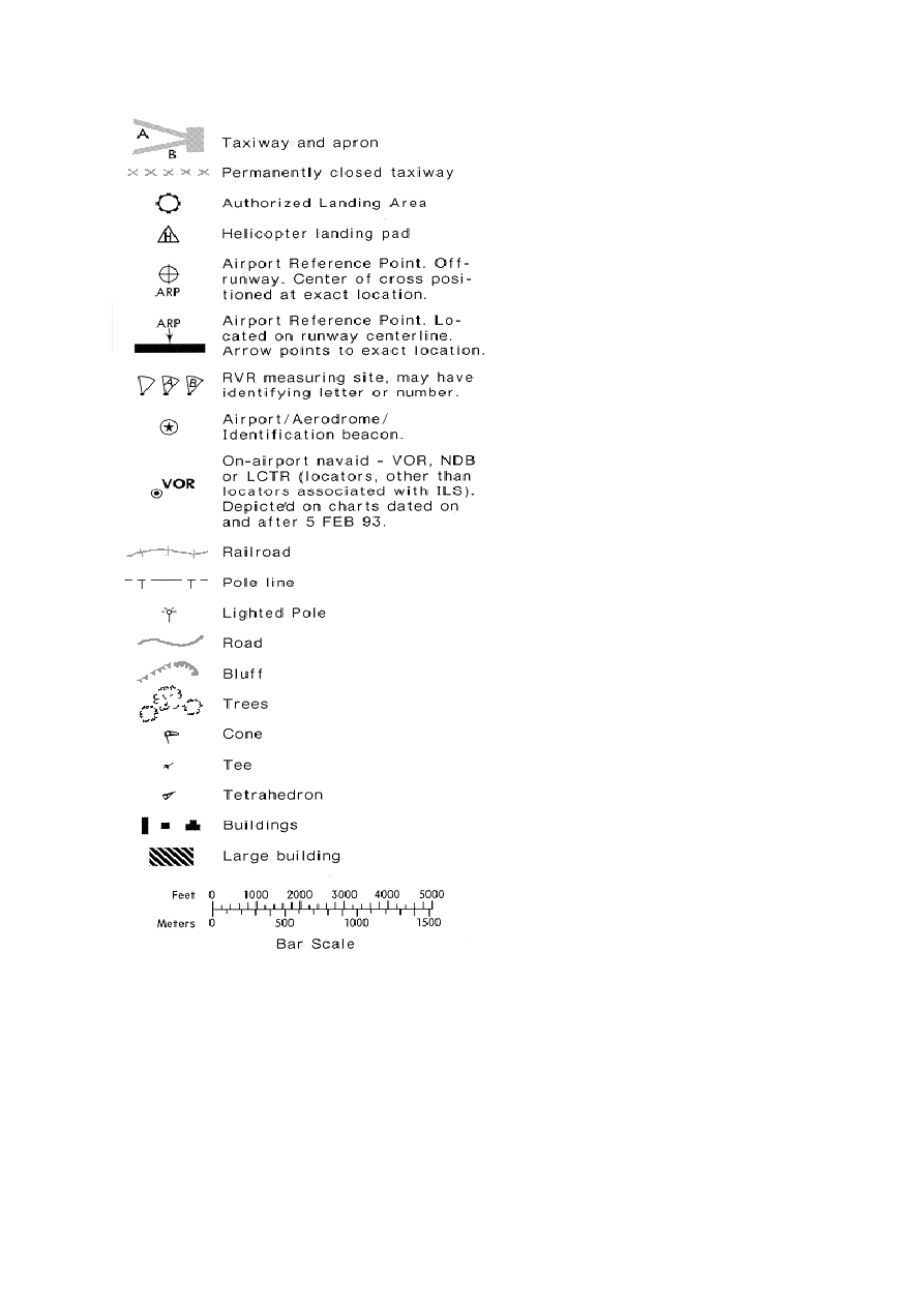
ADDITIONAL INFORMATION
Runway end elevations are shown on the airport diagram if source is available.
Approach lights and beacons are the only lighting symbolized on the airport diagram. Approach
lights are normally shown to scale in a recognizable form. For
approach light symbols
see page 121.
A representative selection of reference points known to Jeppesen is depicted. The elevation of
reference points depicted is above mean sea level (MSL).
Latitude and longitude ticks at tenths of a minute interval are charted around most planview neatlines.
Wyszukiwarka
Podobne podstrony:
Printing Plan View
Printing Airports Enroute
Printing Airport Chart Format & Heading
Printing Briefing Strip Airport Chart Format
Printing Formats Approach & Airport
Printing ICAO Recommended Airport Signs
Printing Profile View
Plan marketingowy 1
Plan pracy na 2011 pps
Damage Control Plan
Plan Balcerowicza
Wykład 7 Wieloletni Plan Finansowy
7 Plan sieciowy
plan wspier
2 1 I B 03 ark 02 zbiorczy plan kolizji
Plan Tygodniowy lyoness weekly plan PL
więcej podobnych podstron