
Wprowadzenie do PostGIS

Przykłady geometrii WKT
• POINT(0 0)
• LINESTRING(0 0,1 1,1 2)
• POLYGON((0 0,4 0,4 4,0 4,0 0),(1 1, 2 1, 2 2,
1 2,1 1))
• MULTIPOINT(0 0,1 2)
• MULTILINESTRING((0 0,1 1,1 2),(2 3,3 2,5 4))
• MULTIPOLYGON( ((0 0,4 0,4 4,0 4,0 0),(1 1,2
1,2 2,1 2,1 1)), ((-1 -1,-1 -2,-2 -2,-2 -1,-1 -1)) )
• GEOMETRYCOLLECTION(POINT(2
3),LINESTRING((2 3,3 4)))

Informacje podstawowe
• Wymagania specyfikacji OGC:
– obiekty przestrzenne powinny być przechowywane
razem z identyfikatorem układu odniesień
przestrzennych (spatial referencing system identifier,
SRID)
– SRID jest wymagany przy tworzeniu obiektów
przestrzennych wstawianych do bazy danych
• Transformacje formatów reprezentacji obiektów
przestrzennych
– bytea WKB = asBinary(geometry);
– text WKT = asText(geometry);
– geometry = GeomFromWKB(bytea WKB, SRID);
– geometry = GeometryFromText(text WKT, SRID);
INSERT INTO SPATIALTABLE (THE_GEOM, THE_NAME )
VALUES ( GeomFromText(’POINT(-126.4 45.32)’, 312), ’A Place’ )

Informacje podstawowe
• PostGIS EWKB, EWKT …
– Specyfikacja OGC definiuje tylko geometrię 2d, a
SRID nie jest włączany w reprezentacjach we/wy
– PostGIS to rozszerza formaty OGC,
wprowadzając EWKB, EWKT (każda geometria w
postaci WKB/WKT jest poprawnym wyrażeniem
EWKB/EWKT)
– rozszerzenie może przysporzyć problemy w
przyszłości
• PostgisEWKB/EWKT
– uwzględnia współrzędne 3dm, 3dz, 4d oraz
dopuszcza włączanie informacji SRID

OGC Simple Features
Specification for SQL
• Definiuje
– standardowe typy obiektów
przestrzennych
– funkcje do manipulacji obiektami
przestrzennymi
– zbiór tabel z metadanymi
• Istnieją dwie tabele metadanych OGC
– SPATIAL_REF_SYS
– GEOMETRY_COLUMNS table

Tabela geometry_columns
Column | Type | Modifiers
--------------------+------------------------+-----------
f_table_catalog | character varying(256) | not null
f_table_schema | character varying(256) | not null
f_table_name | character varying(256) | not null
f_geometry_column | character varying(256) | not null
coord_dimension | integer | not null
srid | integer | not null
type | character varying(30) | not null
Indexes:
"geometry_columns_pk" PRIMARY KEY, btree
(f_table_catalog, f_table_schema, f_table_name,
f_geometry_column)

Tabela geometry_columns
• F_TABLE_NAME
– W pełni kwalifikowana nazwa tabeli obiektów zawierającą kolumnę z
geometrią
• F_TABLE_CATALOG, F_TABLE_SCHEMA
– „catalog” i „schema” to terminy Oracle’owe.
– „catalog” w PostgreSQL nie występuje, stąd kolumna o tej nazwie jest pusta
– „schema” w PostgreSQL występuje, stąd kolumna zawiera nazwę użytego
schematu (domyślnie public).
• F_GEOMETRY_COLUMN
– nazwa kolumny z geometrią w tablicy obiektów
• COORD_DIMENSION
– wymiar przestrzenny kolumny (2, 3 lub 4)
• SRID
– Identyfikator układu odniesień przestrzennych używanego dla współrzędnych
przechowywanej w tabeli geometrii (klucz obcy do SPATIAL_REF_SYS)
• TYPE
– typ obiektu przestrzennego przechowywanego w kolumnie z geometrią,
może być jednym z: POINT, LINESTRING, POLYGON, MULTIPOINT,
MULTILINESTRING, MULTIPOLYGON, GEOMETRYCOLLECTION
– dla kolekcji heterogenicznych można GEOMETRY jako deklaracji typu
– w nowszych wydaniach PostGIS jest jeszcze typ GEOGRAPHY

Tabela spatial_ref_sys
Column | Type | Modifiers
------------+------------------------+-----------
srid | integer | not null
auth_name | character varying(256) |
auth_srid | integer |
srtext | character varying(2048)|
proj4text | character varying(2048)|
Indexes:
"spatial_ref_sys_pkey" PRIMARY KEY, btree (srid)
SRID
• An integer value that uniquely identifies the Spatial Referencing System
(SRS) within the database. e.g., SRID = 4326 is the WGS84
AUTH_NAME
• The name of the standard or standards body that is being cited for this
reference system. For example, "EPSG" would be a valid AUTH_NAME.
AUTH_SRID
• The ID of the Spatial Reference System as defined by the Authority cited in
the AUTH_NAME. In the case of EPSG, this is where the EPSG projection
code would go.e.g., the 4326 for the “EPSG:4326” (WGS84)
SRTEXT
• The Well-Known Text representation of the Spatial Reference System.

Przykładowy SRTEXT
PROJCS["NAD83 / UTM Zone 10N",
GEOGCS["NAD83",
DATUM["North_American_Datum_1983",
SPHEROID["GRS 1980",6378137,298.257222101]
],
PRIMEM["Greenwich",0],
UNIT["degree",0.0174532925199433]
],
PROJECTION["Transverse_Mercator"],
PARAMETER["latitude_of_origin",0],
PARAMETER["central_meridian",-123],
PARAMETER["scale_factor",0.9996],
PARAMETER["false_easting",500000],
PARAMETER["false_northing",0],
UNIT["metre",1]
]

PROJ4TEXT
• PostGIS wykorzystuje bibliotekę Proj4
do transformacji układów odniesień
przestrzennych
• Kolumna PROJ4TEXT zawiera ciąg
znaków definiujący dany SRID
zgodnie z Proj4
– +proj=utm +zone=10 +ellps=clrk66
+datum=NAD27 +units=m
– +proj=longlat +ellps=WGS84
+datum=WGS84 +no_defs

Tworzenie tabel z danymi
przestrzennymi
1. Utwórz tabelę w „zwykły” sposób,
nazywając atrybuty wg potrzeb.
2. Dodaj kolumnę z geometrią metodą
AddGeometryColumn należącą do
rozszerzenia przestrzennego
PostGIS/OGC
3. Wstaw dane przestrzenne stosując
wyrażenia SQL insert & select

Krok 1
• Utworzenie tabeli
CREATE TABLE "public"."dublin_historical“
(gid serial PRIMARY KEY,
"rmp_prop" int8,
"map_symbol" int8,
"entity_id" varchar(7),
"co_id" int8,
"smr_val0" numeric,
"nat_grid_e" numeric,
"class_desc" varchar(255),
"nat_grid_n" numeric,
"objectid" int8,
"townlands" varchar(255),
"scope_n1" varchar(255),
"smrs" varchar(255));
W odpowiedzi PostgreSQL/PostGIS
napisze:
NOTICE: CREATE TABLE will create
implicit sequence
"dublin_historical_gid_seq" for
serial column
"dublin_historical.gid"
NOTICE: CREATE TABLE / PRIMARY
KEY will create implicit index
"dublin_historical_pkey" for table
"dublin_historical"

Krok 2
• Wstawienie kolumny z geometrią
SELECT
AddGeometryColumn('public','dub
lin_historical','the_geom','299
00','POINT',2);
W przykładzie posłużono się układem
SRID = 29900 (Irish National Grid ).
Geometrią przechowywaną w kolumnie tabeli
będzie POINT.

Krok 2
• Wstawienie ograniczeń na geometrię
(wymiar 2)
ALTER TABLE dublin_historical DROP
CONSTRAINT enforce_dims_the_geom;
ALTER TABLE dublin_historical
ADD CONSTRAINT enforce_dims_the_geom CHECK
(ndims(the_geom) = 2);

Krok 2
• Wstawienie kolejnych ograniczeń na
geometrię (POINT lub NULL)
ALTER TABLE
dublin_historical
ADD CONSTRAINT
enforce_geotype_the_geom CHECK
(geometrytype(the_geom) =
‘POINT'::text OR the_geom IS
NULL);

Krok 2
• Wstawienie kolejnych ograniczeń na
geometrię (SRID)
ALTER TABLE
dublin_historical
ADD CONSTRAINT
enforce_srid_the_geom CHECK
(srid(the_geom) = 29900);

Krok 3
• Przepisanie danych do utworzonej tabeli
insert into "dublin_historical"
("rmp_prop","map_symbol", "entity_id",
"co_id","smr_val0",
"nat_grid_e“ ,"class_desc","nat_grid_n","obj
ectid", "townlands","scope_n1", "smrs",
the_geom)
select "rmp_prop", "map_symbol", "entity_id",
"co_id","smr_val0", "nat_grid_e",
"class_desc", "nat_grid_n", "objectid",
"townlands", "scope_n1", "smrs", h.the_geom
from "county" c, historical h where
contains(c.the_geom,h.the_geom) and
name = 'Dublin';

Załadowanie danych z pliku i
eksport do pliku
• użycie shp2pgsql (konwersja ESRI Shape do SQL)
# shp2pgsql shaperoads myschema.roadstable >
roads.sql
• użycie komendy psql:
# psql -d roadsdb -f roads.sql
• użycie shp2pgsql (łączącego się z bazą danych,
konwertującego tabelę, zdefiniowaną opcjonalnym
zapytaniem, do pliku shp)
# pgsql2shp [<options>] <database>
[<schema>.]<table>
# pgsql2shp [<options>] <database> <query>
(<options>: host, user, password, filename, port,
geometry column, etc.)

Operatory
&& : sprawdza, czy BBOX jednej
geometrii przecina się z BBOX drugiej
~= : sprawdza, czy dwie geometrie są
identyczne geometrycznie
= : sprawdzam czy BBOXy dwóch
geometrii są takie same

Indeksy wspierane przez
PostGIS
• B-Trees
– They are used for data which can be sorted along one axis (no
use for GIS data)
• R-Trees
– break up data into rectangles, and sub-rectangles, and sub-sub
rectangles, etc. R-Trees are used by some spatial databases to
index GIS data, but the PostgreSQL R-Tree implementation is
not as robust as the GiST implementation
• GiST (Generalized Search Trees)
– break up data into "things to one side", "things which overlap",
"things which are inside" and can be used on a wide range of
data-types, including GIS data. PostGIS uses an R-Tree index
implemented on top of GiST to index GIS data
CREATE INDEX [indexname] ON [tablename]
USING GIST ( [geometryfield] GIST_GEOMETRY_OPS );

GiST (Generalized Search
Trees)
• only the bounding-box-based operators such as
&& can take advantage of the GiST spatial index
– This is very slow…
SELECT the_geom FROM geom_table
WHERE distance( the_geom,
GeomFromText( ’POINT(100000
200000)’, -1 ) ) < 100
– If a GiST is available over the_geom, the following is
much more efficient...
SELECT the_geom FROM geom_table
WHERE the_geom && ’BOX3D(90900 190900, 100100
200100)’::box3d
AND distance( the_geom,
GeomFromText( ’POINT(100000
200000)’, -1 ) ) < 100

PostGIS (OGC) Functions
• Management Functions
– AddGeometryColumn(varchar, varchar,
varchar, integer,varchar, integer)
– DropGeometryColumn(varchar, varchar,
varchar))
– SetSRID(geometry)

PostGIS (OGC) Functions
• Geometry Relationship Functions
– Distance(geometry,geometry)
– Equals(geometry,geometry)
– Disjoint(geometry,geometry)
– Intersects(geometry,geometry)
– Touches(geometry,geometry)
– Crosses(geometry,geometry)
– Within(geometry,geometry)
– Overlaps(geometry,geometry)
– Contains(geometry,geometry)
– Relate(geometry,geometry,
intersectionPatternMatrix)
– Relate(geometry,geometry)

PostGIS (OGC) Functions
• Geometry Processing Functions
– Centroid(geometry)
– Area(geometry)
– Length(geometry)
– PointOnSurface(geometry)
– Boundary(geometry)
– Buffer(geometry,double,[integer])
– ConvexHull(geometry)
– Intersection(geometry,geometry)
– SymDifference(geometry,geometry)
– Difference(geometry,geometry)
– GeomUnion(geometry,geometry)
– GeomUnion(geometry set)
– MemGeomUnion(geometry set)

PostGIS (OGC) Functions
• Geometry Accessors
– AsText(geometry)
– AsBinary(geometry)
– SRID(geometry)
– Dimension(geometry)
– Envelope(geometry)
– IsEmpty(geometry)
– IsSimple(geometry)
– IsClosed(geometry)
– IsRing(geometry)
– NumGeometries(geometry)
– GeometryN(geometry,int)

PostGIS (OGC) Functions
• Geometry Accessors
– NumPoints(geometry)
– PointN(geometry,integer)
– ExteriorRing(geometry)
– NumInteriorRings(geometry)
– InteriorRingN(geometry,integer)
– EndPoint(geometry)
– StartPoint(geometry)
– GeometryType(geometry)
– X(geometry)
– Y(geometry)
– Z(geometry)

PostGIS (OGC) Functions
• Geometry Constructors
– GeomFromText(text,[<srid>])
– PointFromText(text,[<srid>])
– LineFromText(text,[<srid>])
– LinestringFromText(text,[<srid>])
– PolyFromText(text,[<srid>])
– PolygonFromText(text,[<srid>])
– MPointFromText(text,[<srid>])
– MLineFromText(text,[<srid>])
– MPolyFromText(text,[<srid>])
– GeomCollFromText(text,[<srid>])

PostGIS (OGC) Functions
• Geometry Constructors (cont’)
– GeomFromWKB(bytea,[<srid>])
– PointFromWKB(bytea,[<srid>])
– LineFromWKB(bytea,[<srid>])
– LinestringFromWKB(bytea,[<srid>])
– PolyFromWKB(bytea,[<srid>])
– PolygonFromWKB(bytea,[<srid>])
– MPointFromWKB(bytea,[<srid>])
– MLineFromWKB(bytea,[<srid>])
– MPolyFromWKB(bytea,[<srid>])
– GeomCollFromWKB(bytea,[<srid>])

PostGIS Extensions
• PostGIS also offers … functions not
supported by OGC
– Management Functions
– Operators
– Measurement Functions
– Geometry Outputs
– Geometry Constructors
– Geometry Editors
– Misc

Sprawdzanie poprawności
geometrii
select IsValid(the_geom) from lakes;
NOTICE: Self-intersection at or near point 114275 271699
NOTICE: Self-intersection at or near point 124552 240642
NOTICE: Self-intersection at or near point 121283 305664
isvalid
---------
t
t
f
f
f
t
t
t

Punkt centralny hrabstwa
select name,
asText(Centroid(the_geom)) from
county;

Znajdowanie prostokąta
ograniczającego
• BBOX dla każdego hrabstwa:
select name,
asText(envelope(the_geom)) from county;
lub
select name, extent(the_geom) from
county group by name;
• group by pozwala na przetworzenie wielu
poligonów, extent zwraca geometrię jako
tekst.

Znajdowanie wymiaru
prostokąta ograniczającego
• Na początek można znaleźć BBOX
select name, extent(the_geom) from county
where name= 'Dublin' group by name;
• wynik:
Dublin | BOX(297049.5 215877.484375,330201.8125
266854.40625)
• mając współrzędne narożników można obliczyć ich
odległość:
select distance(
geomFromText(‘Point….)’),
geomFromText(‘Point….)’));

Znajdowanie punktów w
wielokącie
• Do tego zadania można użyć
niestandardowego operatora &&.
• SELECT name FROM original_county
where GeomFromText('POINT(309612.0
233192.0)', 29900) && the_geom;
• Tworząc zapytania należy pamiętać, że
tylko operatory bazujące na BBOX jak && w
pełni mogą wykorzystać indeks
przestrzenny GiST PostgreSQL’a

Znajdowanie obiektów w
okolicach punktu
SELECT townlands FROM dublin_historical
WHERE distance(the_geom,
GeomFromText('POINT(309612.0 233192.0)',
29900)) < 100;
SELECT c.name, h.townlands
FROM county AS c, dublin_historical AS h
WHERE distance(h.the_geom,
GeomFromText('POINT(317431.0 231704.0)',
29900)) < 1000 and c. Name = 'Dublin County
Borough';

Znajdowanie obiektów w
okolicach punktu
SELECT c.name, h.townlands
FROM county AS c,dublin_historical AS h
WHERE st_dwithin(h.the_geom,
PointFromText('POINT(317431.0 231704.0)',
29900),1000) and c. Name = '
Dublin County
Borough
';
SELECT gid,townlands
FROM dublin_historical
WHERE st_dwithin(the_geom,
GeomFromText('POINT(317431.0 231704.0)',29900),500)
ORDER BY st_dwithin(the_geom,
GeomFromText('POINT(317431.0 231704.0)',29900),500)
LIMIT 100;

Znajdowanie największego
hrabstwa
SELECT name, area(the_geom)/10000 AS
hectares FROM county ORDER BY hectares
DESC LIMIT 1;
SELECT name, area(the_geom)/10000 AS
hectares FROM county
WHERE name != 'Northern Ireland‘ ORDER BY
hectares DESC LIMIT 1;

Analizy przestrzenne z drogami
• Długość dróg w pełni zawartych w Dublin Borough
SELECT c.name, sum(length(r.the_geom))/1000
as roads_km FROM roads AS r, county AS c
WHERE r.the_geom && r.the_geom
AND contains(c.the_geom,r.the_geom)
AND c.name = 'Dublin County Borough'
GROUP BY c.name
ORDER BY roads_km;
• Obiekty historyczne w pobliżu dróg hrabstwa Dublin
SELECT townlands FROM dublin_historical h,
roads r, county c WHERE
distance(h.the_geom,r.the_geom) < 1000
AND c.name = 'Dublin County Borough';

Nakładanie się obiektów
• Możliwe są testy sprawdzające
przecinanie się obiektów oraz
operacje przecięcia:
ST_Intersects(a,b)=TRUE | FALSE
ST_Intersection(a,b)=GEOMETRY
Niuanse analiz
przestrzennych
Niuanse analiz przestrzennych
• Oryginalne zapytanie:
SELECT the_geom, name
FROM neighborhoods
WHERE name IN('Hyde Park','Roxbury')
• expand: tworzy prostokąt, który rozszerza o 500 jednostek bbox dla każdej
geometrii
SELECT ST_Expand(the_geom,500) as geom, name
FROM neighborhoods
WHERE name IN('Hyde Park','Roxbury')
• extent: tworzy pojedynczy bbox wokół wybranych geometrii
SELECT ST_Extent(the_geom) as thebbox, name
FROM neighborhoods
WHERE name IN('Hyde Park','Roxbury')
• buffer: rozszerza każdą geometrię o 500 jednostek
SELECT ST_Buffer(the_geom,500) as geom, name
FROM neighborhoods
WHERE name IN('Hyde Park','Roxbury')

Expand
--box meter expanded box around bbox of a linestring
SELECT CAST(ST_Expand(ST_GeomFromText(’LINESTRING(2312980
110676,2312923 110701,2312892 110714)’, 2163),10) As box2d);
st_expand
------------------------------------
BOX(2312882 110666,2312990 110724)
--10 meter expanded 3d box of a 3d box
SELECT ST_Expand(CAST(’BOX3D(778783 2951741 1,794875
2970042.61545891 10)’ As box3d),10)
st_expand
-----------------------------------------------------
BOX3D(778773 2951731 -9,794885 2970052.61545891 20)
--10 meter geometry astext rep of a expand box around a point geometry
SELECT
ST_AsEWKT(ST_Expand(ST_GeomFromEWKT(’SRID=2163;POINT(2312980
110676)’),10));
st_asewkt
------------------------------------------------------------------------------------------------- -
SRID=2163;POLYGON((2312970 110666,2312970 110686,2312990
110686,2312990 110666,2312970 -
110666))

Extent
SELECT ST_Extent(the_geom) as bextent FROM sometable;
st_bextent
------------------------------------
BOX(739651.875 2908247.25,794875.8125 2970042.75)
--Return extent of each category of geometries
SELECT ST_Extent(the_geom) as bextent
FROM sometable
GROUP BY category ORDER BY category;
bextent | name
----------------------------------------------------+----------------
BOX(778783.5625 2951741.25,794875.8125 2970042.75) | A
BOX(751315.8125 2919164.75,765202.6875 2935417.25) | B
BOX(739651.875 2917394.75,756688.375 2935866) | C
--Force back into a geometry
PostGIS 1.5.2 Manual
262 / 317
-- and render the extended text representation of that geometry
SELECT ST_SetSRID(ST_Extent(the_geom),2249) as bextent FROM sometable;
bextent
--------------------------------------------------------------------------------
SRID=2249;POLYGON((739651.875 2908247.25,739651.875 2970042.75,794875.8125
2970042.75,
794875.8125 2908247.25,739651.875 2908247.25))
Buffer
--A buffered point approximates a circle
SELECT ST_NPoints(ST_Buffer(ST_GeomFromText(’POINT(100 90)’), 50))
As promisingcircle_pcount,
ST_NPoints(ST_Buffer(ST_GeomFromText(’POINT(100 90)’), 50, 2)) As
lamecircle_pcount;
promisingcircle_pcount | lamecircle_pcount
------------------------+-------------------
33 | 9
Zapytania o sieć drogową
Najkrótsza droga z
Dublina do
Waterford
• Możliwe dzięki pgRouting
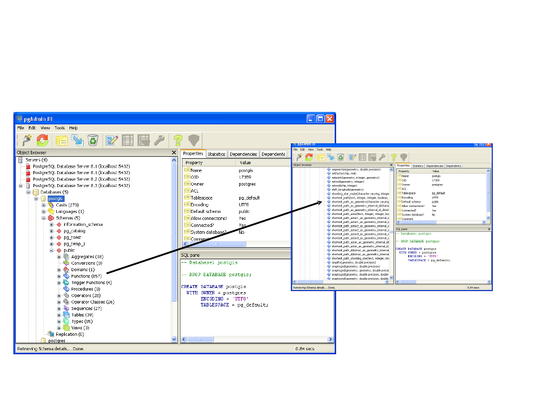
Przegląd dostępnych w
pgRouting zapytań za pomocą
pgAdmin III

Network Queries
-- The start node 381 is in Dublin
-- The destination is node 660 in Waterford
-- Must return columns 'id', 'source', 'target' and
'cost'
SELECT * FROM shortest_path('
SELECT gid as id,
source::integer,
target::integer,
length::double precision as cost
FROM all_roads_e',
381, 660, false, false);

Network Queries
The edges are stored in all_roads_e
The source and target information was created in
OpenJump using Tools | Analysis | Planar Graph.
Details will be described in labs:
----------+------------------+--------------------
gid | integer | not null default nextval('egclass)
id | bigint
source | bigint
target | bigint
the_geom | geometry
length | double precision

Długość wszystkich odcinków
dróg w pełni zawartych w
hrabstwie
SELECT
Sum(ST_Length(r.the_geom))/1000
AS kilometers
FROM
all_roads r,
dublin_regions dr
WHERE
ST_Contains(dr.the_geom,
r.the_geom) AND
dr.name = ‘Dublin County
Borough';

Zapytania
• Dwa domy w odległości 500 metrów od biblioteki z
największą liczbą mieszkańców
SELECT b1.residents
FROM buildings b1, buildings b2
WHERE
b2.name = 'CHESTER BEATTY LIBRARY' and
ST_DWithin(b2.the_geom,b1.the_geom, 500) ORDER BY
residents DESC LIMIT 2;
• Hrabstwa mające dokładnie jednego sąsiada
SELECT c1.name
FROM all_counties c1, all_counties c2
WHERE touches(c1.the_geom, c2.the_geom) = 'TRUE'
GROUP BY c1.name
HAVING count(c2.name) =1;

Szerokość geograficzna
budynków wysuniętych
najbardziej na północ i na
południe
SELECT st_y(st_transform(the_geom,4326)) AS
latitude from buildings ORDER BY latitude
DESC limit 1;
SELECT st_y(st_transform(the_geom,4326)) AS
latitude from buildings ORDER BY latitude
ASC limit 1;
SELECT st_y(the_geom) AS easting FROM
buildings ORDER BY easting DESC limit 1;

Zapytania arytmetyczne
SELECT saps_label,primary_degree10_4,(male1_1 + female1_1) as Pop,
((cast (primary_degree10_4 as float)) / (cast ((male1_1 +
female1_1) as float)) * 100) as Grad_percent
FROM dublin_eds
WHERE primary_degree10_4 IS NOT NULL
ORDER BY Grad_percent
DESC LIMIT 1;
saps_label | primary_degree10_4 | pop | grad_percent
--------------------+--------------------+------+--------------
117 Mansion House A | 279 | 3802 |7.33824302998422
Document Outline
- Slide 1
- Slide 2
- Slide 3
- Slide 4
- Slide 5
- Slide 6
- Slide 7
- Slide 8
- Slide 9
- Slide 10
- Slide 11
- Slide 12
- Slide 13
- Slide 14
- Slide 15
- Slide 16
- Slide 17
- Slide 18
- Slide 19
- Slide 20
- Slide 21
- Slide 22
- Slide 23
- Slide 24
- Slide 25
- Slide 26
- Slide 27
- Slide 28
- Slide 29
- Slide 30
- Slide 31
- Slide 32
- Slide 33
- Slide 34
- Slide 35
- Slide 36
- Slide 37
- Slide 38
- Slide 39
- Slide 40
- Slide 41
- Slide 42
- Slide 43
- Slide 44
- Slide 45
- Slide 46
- Slide 47
- Slide 48
- Slide 49
- Slide 50
- Slide 51
- Slide 52
Wyszukiwarka
Podobne podstrony:
Wykład 1 inżynierskie Wprowadzenie do zarządzania operacyjnego
Wprowadzenie do medycyny rozwojowej 1
PD W1 Wprowadzenie do PD(2010 10 02) 1 1
Wprowadzenie do psychologii
Wprowadzenie do filozofii
(1) Wprowadzenie do nauki o finansach 1id 778 ppt
wprowadzenie do systemu win i podst sieci
wprowadzenie do psychologii społecznej
Wprowadzenie do cw1A
1 Wprowadzenie do psychologii pracy (14)id 10045 ppt
MWB 1 Wprowadzenie do modelowania wymagań w bezpieczeństwie
Wprowadzenie do Kryptografii
Wprowadzenie do pomocy społecznej
ZZL USWyklad 1 Wprowadzenie do tematyki
Wprowadzenie do psychologii religii
Wprowadzenie do odwarstwienia siatkówki (RD)
więcej podobnych podstron